You are here: Home > Network List > GS - US Geological Survey Networks Stations List
> Station KAN13 Rinehart Farm > Earthquake Result Viewer
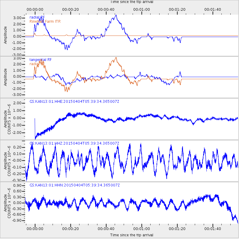
KAN13 Rinehart Farm - Earthquake Result Viewer
*The percent match for this event was below the threshold and hence no stack was calculated.
| Earthquake location: |
Tonga Islands |
| Earthquake latitude/longitude: |
-17.7/-174.0 |
| Earthquake time(UTC): |
2015/04/04 (094) 05:27:08 GMT |
| Earthquake Depth: |
35 km |
| Earthquake Magnitude: |
4.6 mb |
| Earthquake Catalog/Contributor: |
ISC/ISC |
|
| Network: |
GS US Geological Survey Networks |
| Station: |
KAN13 Rinehart Farm |
| Lat/Lon: |
37.01 N/97.48 W |
| Elevation: |
340 m |
|
| Distance: |
90.2 deg |
| Az: |
51.116 deg |
| Baz: |
247.999 deg |
| Ray Param: |
$rayparam |
*The percent match for this event was below the threshold and hence was not used in the summary stack. |
|
| Radial Match: |
28.938652 % |
| Radial Bump: |
400 |
| Transverse Match: |
27.164408 % |
| Transverse Bump: |
400 |
| SOD ConfigId: |
7422571 |
| Insert Time: |
2019-04-18 02:25:42.564 +0000 |
| GWidth: |
2.5 |
| Max Bumps: |
400 |
| Tol: |
0.001 |
|
Signal To Noise
| Channel | StoN | STA | LTA |
| GS:KAN13:01:HHZ:20150404T05:39:34.365007Z | 1.0202329 | 1.136966E-7 | 1.1144181E-7 |
| GS:KAN13:01:HHN:20150404T05:39:34.365007Z | 1.4876082 | 2.96364E-7 | 1.992218E-7 |
| GS:KAN13:01:HHE:20150404T05:39:34.365007Z | 1.0448998 | 1.0926925E-6 | 1.0457389E-6 |
| Arrivals |
| Ps | |
| PpPs | |
| PsPs/PpSs | |


