NIL Nilore, Pakistan - Earthquake Result Viewer
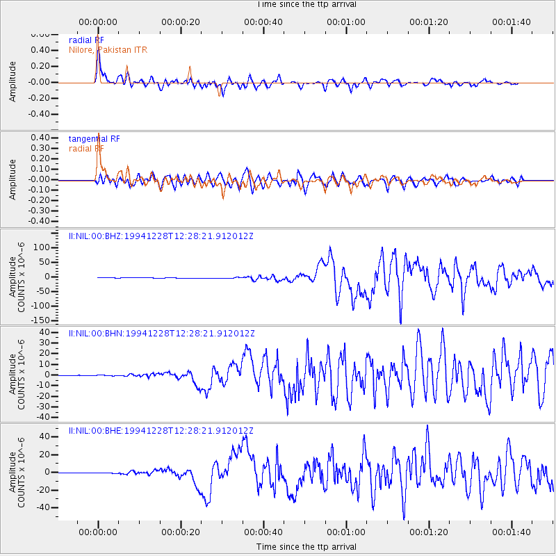
Earthquake location: Off East Coast Of Honshu, Japan
Earthquake latitude/longitude: 40.5/143.5
Earthquake time(UTC): 1994/12/28 (362) 12:19:23 GMT
Earthquake Depth: 33 km
Earthquake Magnitude: 6.4 MB, 7.5 MS, 7.2 UNKNOWN, 7.7 MW
Earthquake Catalog/Contributor: WHDF/NEIC
Network: II Global Seismograph Network (GSN - IRIS/IDA)
Station: NIL Nilore, Pakistan
Lat/Lon: 33.65 N/73.27 E
Elevation: 629 m
Distance: 55.1 deg
Az: 286.9 deg
Baz: 61.084 deg
Ray Param: 0.06494148
Estimated Moho Depth: 40.0 km
Estimated Crust Vp/Vs: 2.10
Assumed Crust Vp: 6.242 km/s
Estimated Crust Vs: 2.976 km/s
Estimated Crust Poisson's Ratio: 0.35
Radial Match: 94.24383 %
Radial Bump: 400
Transverse Match: 85.35178 %
Transverse Bump: 400
SOD ConfigId: 61242
Insert Time: 2010-03-02 00:23:14.704 +0000
GWidth: 2.5
Max Bumps: 400
Tol: 0.001

Signal To Noise

ChannelStoNSTALTA
II:NIL:00:BHN:19941228T12:28:21.912012Z2.80041812.9864518E-71.0664307E-7
II:NIL:00:BHE:19941228T12:28:21.912012Z3.15004354.1620544E-71.3212689E-7
II:NIL:00:BHZ:19941228T12:28:21.912012Z8.8394931.2681568E-61.4346487E-7
Arrivals
Ps7.3 SECOND
PpPs19 SECOND
PsPs/PpSs26 SECOND