You are here: Home > Network List > US - United States National Seismic Network Stations List
> Station EGMT Eagleton, Montana, USA > Earthquake Result Viewer
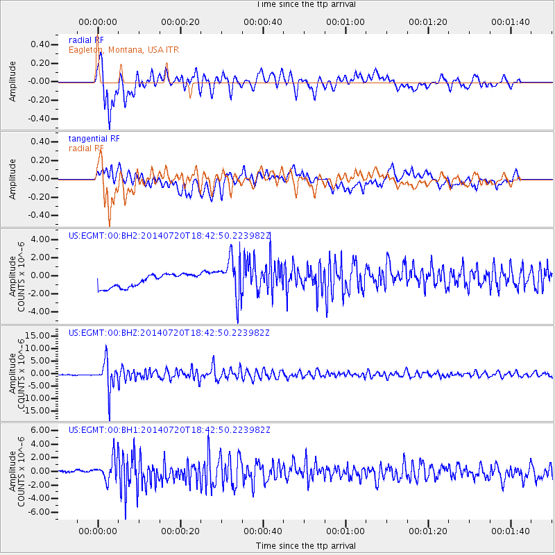
EGMT Eagleton, Montana, USA - Earthquake Result Viewer
*The percent match for this event was below the threshold and hence no stack was calculated.
| Earthquake location: |
Kuril Islands |
| Earthquake latitude/longitude: |
44.6/148.7 |
| Earthquake time(UTC): |
2014/07/20 (201) 18:32:47 GMT |
| Earthquake Depth: |
61 km |
| Earthquake Magnitude: |
6.6 MB |
| Earthquake Catalog/Contributor: |
NEIC PDE/NEIC COMCAT |
|
| Network: |
US United States National Seismic Network |
| Station: |
EGMT Eagleton, Montana, USA |
| Lat/Lon: |
48.02 N/109.75 W |
| Elevation: |
1055 m |
|
| Distance: |
65.0 deg |
| Az: |
46.551 deg |
| Baz: |
309.444 deg |
| Ray Param: |
$rayparam |
*The percent match for this event was below the threshold and hence was not used in the summary stack. |
|
| Radial Match: |
80.140564 % |
| Radial Bump: |
400 |
| Transverse Match: |
69.08304 % |
| Transverse Bump: |
400 |
| SOD ConfigId: |
751272 |
| Insert Time: |
2014-08-04 16:32:04.915 +0000 |
| GWidth: |
2.5 |
| Max Bumps: |
400 |
| Tol: |
0.001 |
|
Signal To Noise
| Channel | StoN | STA | LTA |
| US:EGMT:00:BHZ:20140720T18:42:50.223982Z | 20.62637 | 5.6747804E-6 | 2.751226E-7 |
| US:EGMT:00:BH1:20140720T18:42:50.223982Z | 4.5986514 | 1.7029818E-6 | 3.70322E-7 |
| US:EGMT:00:BH2:20140720T18:42:50.223982Z | 3.283919 | 2.2905408E-6 | 6.9750223E-7 |
| Arrivals |
| Ps | |
| PpPs | |
| PsPs/PpSs | |


