You are here: Home > Network List > UW - Pacific Northwest Regional Seismic Network Stations List
> Station LEBA Lebam, WA, USA > Earthquake Result Viewer
LEBA Lebam, WA, USA - Earthquake Result Viewer
*The percent match for this event was below the threshold and hence no stack was calculated.
| Earthquake location: |
Kuril Islands |
| Earthquake latitude/longitude: |
44.6/148.7 |
| Earthquake time(UTC): |
2014/07/20 (201) 18:32:47 GMT |
| Earthquake Depth: |
61 km |
| Earthquake Magnitude: |
6.6 MB |
| Earthquake Catalog/Contributor: |
NEIC PDE/NEIC COMCAT |
|
| Network: |
UW Pacific Northwest Regional Seismic Network |
| Station: |
LEBA Lebam, WA, USA |
| Lat/Lon: |
46.55 N/123.56 W |
| Elevation: |
73 m |
|
| Distance: |
58.2 deg |
| Az: |
54.2 deg |
| Baz: |
302.954 deg |
| Ray Param: |
$rayparam |
*The percent match for this event was below the threshold and hence was not used in the summary stack. |
|
| Radial Match: |
75.45249 % |
| Radial Bump: |
400 |
| Transverse Match: |
73.57756 % |
| Transverse Bump: |
400 |
| SOD ConfigId: |
751272 |
| Insert Time: |
2014-08-04 16:39:06.291 +0000 |
| GWidth: |
2.5 |
| Max Bumps: |
400 |
| Tol: |
0.001 |
|
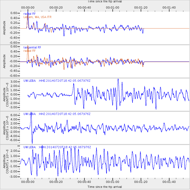
Signal To Noise
| Channel | StoN | STA | LTA |
| UW:LEBA: :HHZ:20140720T18:42:05.067976Z | 10.981574 | 3.1960835E-6 | 2.9104055E-7 |
| UW:LEBA: :HHN:20140720T18:42:05.067976Z | 3.410771 | 1.161454E-6 | 3.4052536E-7 |
| UW:LEBA: :HHE:20140720T18:42:05.067976Z | 3.9551487 | 1.2196409E-6 | 3.083679E-7 |
| Arrivals |
| Ps | |
| PpPs | |
| PsPs/PpSs | |


