NIL Nilore, Pakistan - Earthquake Result Viewer
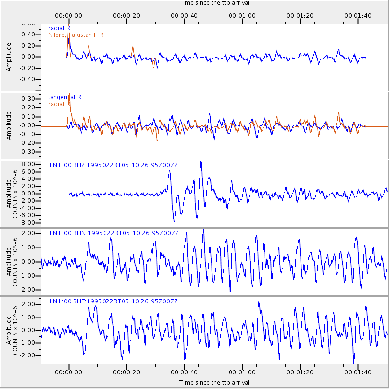
Earthquake location: Off East Coast Of Honshu, Japan
Earthquake latitude/longitude: 39.7/143.7
Earthquake time(UTC): 1995/02/23 (054) 05:01:25 GMT
Earthquake Depth: 33 km
Earthquake Magnitude: 5.5 MB, 6.0 MS, 6.2 UNKNOWN, 6.2 MW
Earthquake Catalog/Contributor: WHDF/NEIC
Network: II Global Seismograph Network (GSN - IRIS/IDA)
Station: NIL Nilore, Pakistan
Lat/Lon: 33.65 N/73.27 E
Elevation: 629 m
Distance: 55.5 deg
Az: 287.516 deg
Baz: 61.944 deg
Ray Param: 0.0646941
Estimated Moho Depth: 50.0 km
Estimated Crust Vp/Vs: 1.87
Assumed Crust Vp: 6.242 km/s
Estimated Crust Vs: 3.338 km/s
Estimated Crust Poisson's Ratio: 0.30
Radial Match: 89.71753 %
Radial Bump: 400
Transverse Match: 83.4751 %
Transverse Bump: 400
SOD ConfigId: 6273
Insert Time: 2010-03-02 00:23:54.487 +0000
GWidth: 2.5
Max Bumps: 400
Tol: 0.001

Signal To Noise

ChannelStoNSTALTA
II:NIL:00:BHN:19950223T05:10:26.957007Z1.25061813.5035416E-72.8014477E-7
II:NIL:00:BHE:19950223T05:10:26.957007Z2.01685174.242315E-72.1034343E-7
II:NIL:00:BHZ:19950223T05:10:26.957007Z8.3672531.8296644E-62.1866965E-7
Arrivals
Ps7.3 SECOND
PpPs22 SECOND
PsPs/PpSs29 SECOND