NIL Nilore, Pakistan - Earthquake Result Viewer
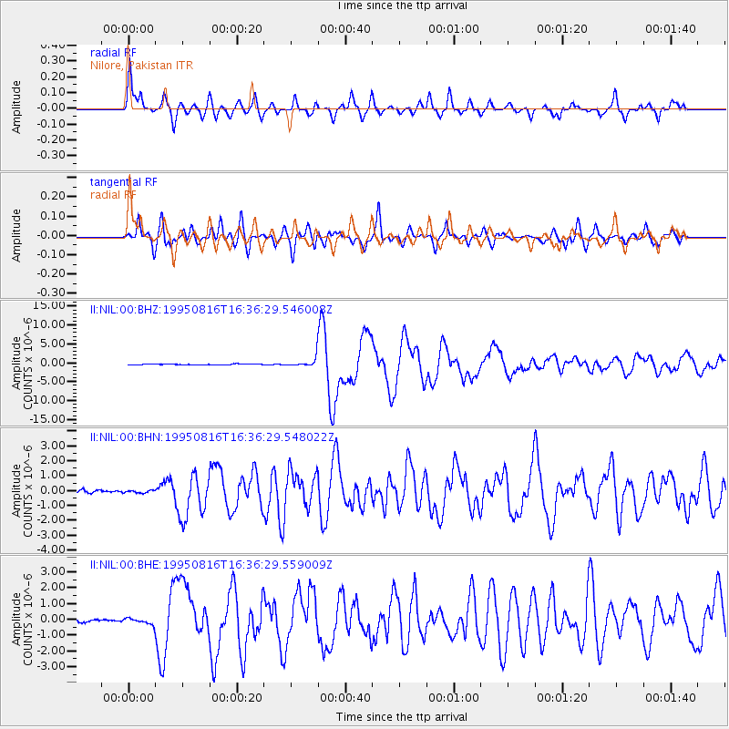
Earthquake location: New Ireland Region, P.N.G.
Earthquake latitude/longitude: -5.4/153.8
Earthquake time(UTC): 1995/08/16 (228) 16:24:26 GMT
Earthquake Depth: 21 km
Earthquake Magnitude: 5.6 MB, 6.8 MS, 6.8 UNKNOWN, 6.6 MW
Earthquake Catalog/Contributor: WHDF/NEIC
Network: II Global Seismograph Network (GSN - IRIS/IDA)
Station: NIL Nilore, Pakistan
Lat/Lon: 33.65 N/73.27 E
Elevation: 629 m
Distance: 85.1 deg
Az: 304.339 deg
Baz: 99.76 deg
Ray Param: 0.044986375
Estimated Moho Depth: 14.5 km
Estimated Crust Vp/Vs: 1.86
Assumed Crust Vp: 6.242 km/s
Estimated Crust Vs: 3.356 km/s
Estimated Crust Poisson's Ratio: 0.30
Radial Match: 89.123245 %
Radial Bump: 352
Transverse Match: 87.169876 %
Transverse Bump: 400
SOD ConfigId: 6273
Insert Time: 2010-03-02 00:24:10.198 +0000
GWidth: 2.5
Max Bumps: 400
Tol: 0.001

Signal To Noise

ChannelStoNSTALTA
II:NIL:00:BHN:19950816T16:36:29.548022Z0.711599357.98545E-81.12218345E-7
II:NIL:00:BHE:19950816T16:36:29.559009Z1.54674551.966406E-71.2713184E-7
II:NIL:00:BHZ:19950816T16:36:29.546008Z10.01104451.1481957E-61.14692895E-7
Arrivals
Ps2.0 SECOND
PpPs6.5 SECOND
PsPs/PpSs8.5 SECOND