You are here: Home > Network List > II - Global Seismograph Network (GSN - IRIS/IDA) Stations List
> Station NIL Nilore, Pakistan > Earthquake Result Viewer
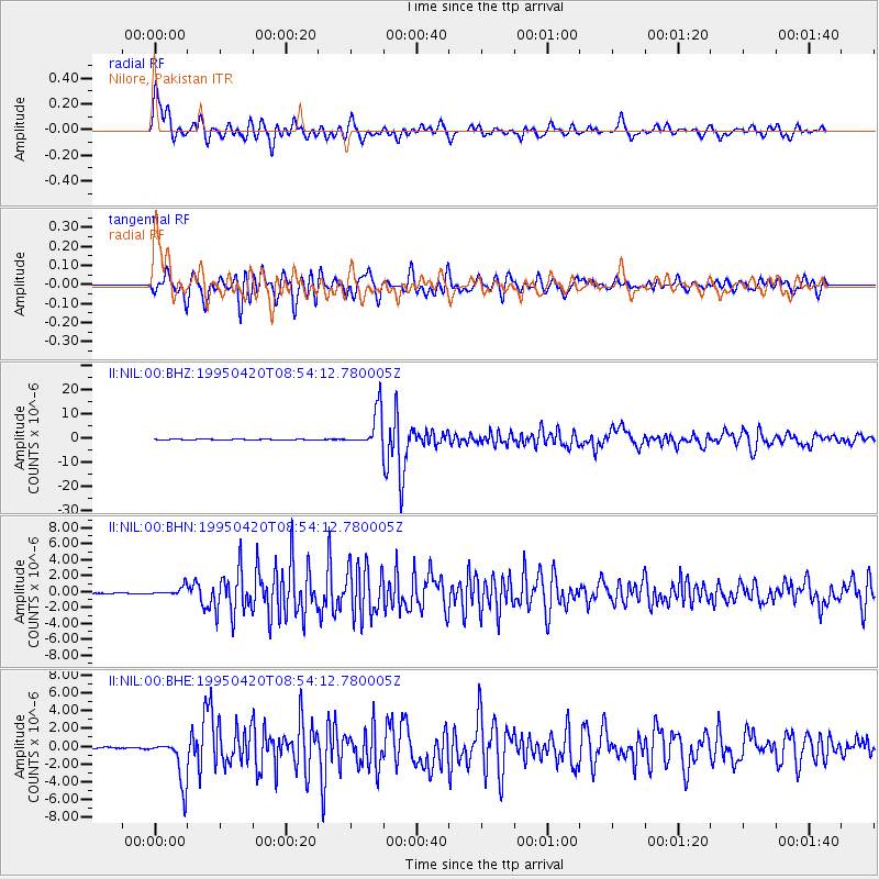
NIL Nilore, Pakistan - Earthquake Result Viewer

| Earthquake location: |
Mindanao, Philippines |
| Earthquake latitude/longitude: |
6.3/126.8 |
| Earthquake time(UTC): |
1995/04/20 (110) 08:45:10 GMT |
| Earthquake Depth: |
85 km |
| Earthquake Magnitude: |
6.2 MB, 6.6 UNKNOWN, 6.5 MW |
| Earthquake Catalog/Contributor: |
WHDF/NEIC |
|
| Network: |
II Global Seismograph Network (GSN - IRIS/IDA) |
| Station: |
NIL Nilore, Pakistan |
| Lat/Lon: |
33.65 N/73.27 E |
| Elevation: |
629 m |
|
| Distance: |
56.5 deg |
| Az: |
306.379 deg |
| Baz: |
106.37 deg |
| Ray Param: |
0.06388366 |
| Estimated Moho Depth: |
14.0 km |
| Estimated Crust Vp/Vs: |
1.87 |
| Assumed Crust Vp: |
6.242 km/s |
| Estimated Crust Vs: |
3.338 km/s |
| Estimated Crust Poisson's Ratio: |
0.30 |
|
| Radial Match: |
89.51334 % |
| Radial Bump: |
400 |
| Transverse Match: |
87.40783 % |
| Transverse Bump: |
400 |
| SOD ConfigId: |
61242 |
| Insert Time: |
2010-03-02 00:24:22.197 +0000 |
| GWidth: |
2.5 |
| Max Bumps: |
400 |
| Tol: |
0.001 |
|
Signal To Noise
| Channel | StoN | STA | LTA |
| II:NIL:00:BHN:19950420T08:54:12.780005Z | 8.492071 | 5.446521E-7 | 6.413655E-8 |
| II:NIL:00:BHE:19950420T08:54:12.780005Z | 42.1479 | 2.5465197E-6 | 6.0418664E-8 |
| II:NIL:00:BHZ:19950420T08:54:12.780005Z | 58.581654 | 7.683493E-6 | 1.3115869E-7 |
| Arrivals |
| Ps | 2.0 SECOND |
| PpPs | 6.2 SECOND |
| PsPs/PpSs | 8.2 SECOND |


