You are here: Home > Network List > US - United States National Seismic Network Stations List
> Station DGMT Dagmar, Montana, USA > Earthquake Result Viewer
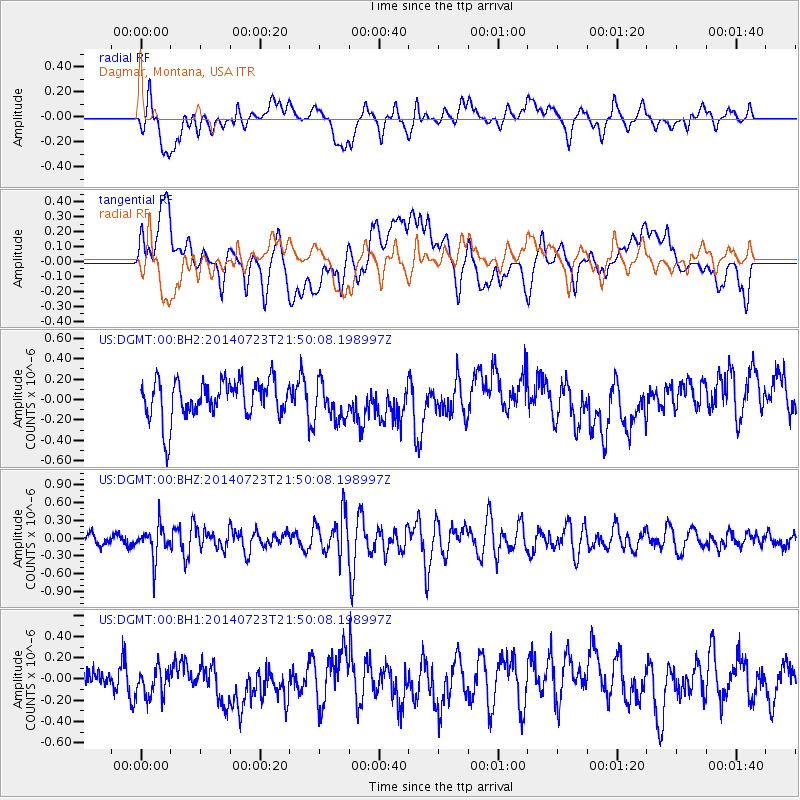
DGMT Dagmar, Montana, USA - Earthquake Result Viewer
*The percent match for this event was below the threshold and hence no stack was calculated.
| Earthquake location: |
Chile-Bolivia Border Region |
| Earthquake latitude/longitude: |
-20.2/-68.7 |
| Earthquake time(UTC): |
2014/07/23 (204) 21:39:08 GMT |
| Earthquake Depth: |
115 km |
| Earthquake Magnitude: |
5.5 M |
| Earthquake Catalog/Contributor: |
NEIC PDE/NEIC COMCAT |
|
| Network: |
US United States National Seismic Network |
| Station: |
DGMT Dagmar, Montana, USA |
| Lat/Lon: |
48.47 N/104.20 W |
| Elevation: |
0.0 m |
|
| Distance: |
75.4 deg |
| Az: |
336.466 deg |
| Baz: |
145.711 deg |
| Ray Param: |
$rayparam |
*The percent match for this event was below the threshold and hence was not used in the summary stack. |
|
| Radial Match: |
66.95594 % |
| Radial Bump: |
400 |
| Transverse Match: |
53.282383 % |
| Transverse Bump: |
400 |
| SOD ConfigId: |
751272 |
| Insert Time: |
2014-08-06 22:37:37.433 +0000 |
| GWidth: |
2.5 |
| Max Bumps: |
400 |
| Tol: |
0.001 |
|
Signal To Noise
| Channel | StoN | STA | LTA |
| US:DGMT:00:BHZ:20140723T21:50:08.198997Z | 2.5303032 | 2.7266515E-7 | 1.0775987E-7 |
| US:DGMT:00:BH1:20140723T21:50:08.198997Z | 1.2723116 | 1.5320606E-7 | 1.2041552E-7 |
| US:DGMT:00:BH2:20140723T21:50:08.198997Z | 1.0138588 | 1.9109704E-7 | 1.8848486E-7 |
| Arrivals |
| Ps | |
| PpPs | |
| PsPs/PpSs | |


