NIL Nilore, Pakistan - Earthquake Result Viewer
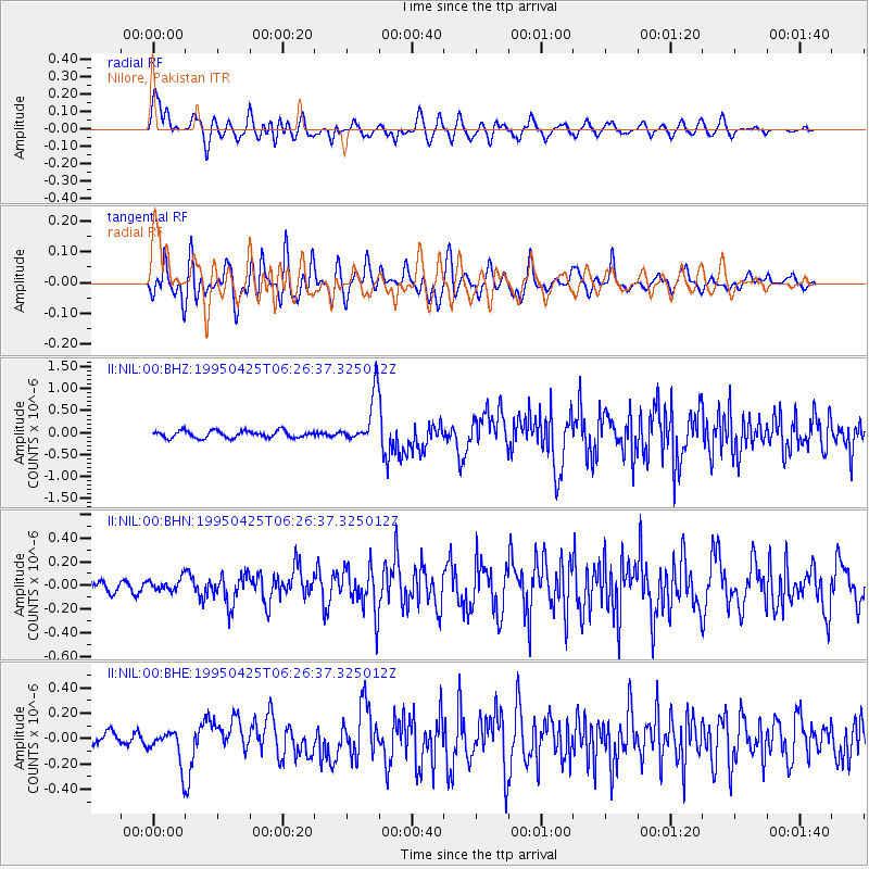
Earthquake location: Eastern New Guinea Reg., P.N.G.
Earthquake latitude/longitude: -5.9/147.3
Earthquake time(UTC): 1995/04/25 (115) 06:15:02 GMT
Earthquake Depth: 33 km
Earthquake Magnitude: 5.6 MB, 5.7 MS, 6.1 UNKNOWN, 6.1 MW
Earthquake Catalog/Contributor: WHDF/NEIC
Network: II Global Seismograph Network (GSN - IRIS/IDA)
Station: NIL Nilore, Pakistan
Lat/Lon: 33.65 N/73.27 E
Elevation: 629 m
Distance: 80.1 deg
Az: 305.496 deg
Baz: 103.83 deg
Ray Param: 0.04848061
Estimated Moho Depth: 14.0 km
Estimated Crust Vp/Vs: 1.91
Assumed Crust Vp: 6.242 km/s
Estimated Crust Vs: 3.272 km/s
Estimated Crust Poisson's Ratio: 0.31
Radial Match: 88.53035 %
Radial Bump: 400
Transverse Match: 82.6685 %
Transverse Bump: 400
SOD ConfigId: 6273
Insert Time: 2010-03-02 00:25:11.167 +0000
GWidth: 2.5
Max Bumps: 400
Tol: 0.001

Signal To Noise

ChannelStoNSTALTA
II:NIL:00:BHN:19950425T06:26:37.325012Z1.05769625.194453E-84.911101E-8
II:NIL:00:BHE:19950425T06:26:37.325012Z3.00942021.3626268E-74.5278718E-8
II:NIL:00:BHZ:19950425T06:26:37.325012Z7.0857775.6501926E-77.973992E-8
Arrivals
Ps2.1 SECOND
PpPs6.4 SECOND
PsPs/PpSs8.4 SECOND