NIL Nilore, Pakistan - Earthquake Result Viewer
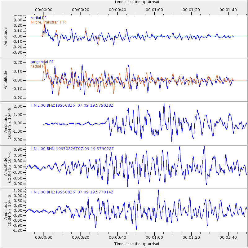
Earthquake location: New Ireland Region, P.N.G.
Earthquake latitude/longitude: -5.8/153.6
Earthquake time(UTC): 1995/08/26 (238) 06:57:17 GMT
Earthquake Depth: 33 km
Earthquake Magnitude: 5.3 MB, 6.1 MS, 6.0 UNKNOWN, 6.1 MW
Earthquake Catalog/Contributor: WHDF/NEIC
Network: II Global Seismograph Network (GSN - IRIS/IDA)
Station: NIL Nilore, Pakistan
Lat/Lon: 33.65 N/73.27 E
Elevation: 629 m
Distance: 85.2 deg
Az: 304.385 deg
Baz: 100.146 deg
Ray Param: 0.04488773
Estimated Moho Depth: 15.0 km
Estimated Crust Vp/Vs: 1.74
Assumed Crust Vp: 6.242 km/s
Estimated Crust Vs: 3.587 km/s
Estimated Crust Poisson's Ratio: 0.25
Radial Match: 86.87474 %
Radial Bump: 400
Transverse Match: 86.922615 %
Transverse Bump: 400
SOD ConfigId: 6273
Insert Time: 2010-03-02 00:25:20.053 +0000
GWidth: 2.5
Max Bumps: 400
Tol: 0.001

Signal To Noise

ChannelStoNSTALTA
II:NIL:00:BHN:19950826T07:09:19.579028Z0.816998545.9239674E-87.250891E-8
II:NIL:00:BHE:19950826T07:09:19.577014Z0.6772835.0161837E-87.406334E-8
II:NIL:00:BHZ:19950826T07:09:19.579028Z2.927242.0353669E-76.953194E-8
Arrivals
Ps1.8 SECOND
PpPs6.4 SECOND
PsPs/PpSs8.3 SECOND