
NIL Nilore, Pakistan - Earthquake Result Viewer
| ||||||||||||||||||
| ||||||||||||||||||
| ||||||||||||||||||
|
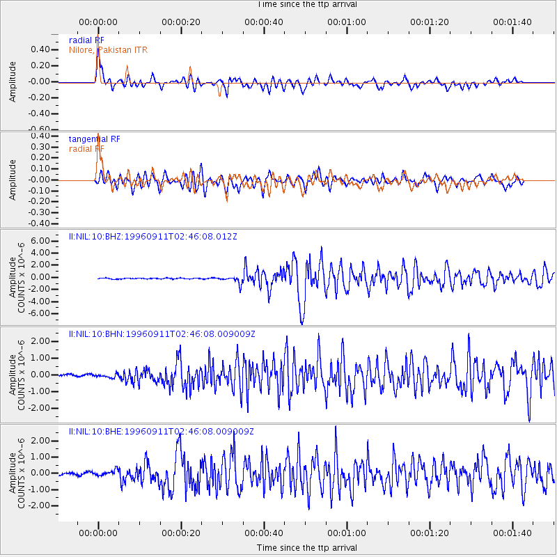
Signal To Noise
| Channel | StoN | STA | LTA |
| II:NIL:10:BHN:19960911T02:46:08.009009Z | 1.329701 | 1.2504998E-7 | 9.4043685E-8 |
| II:NIL:10:BHE:19960911T02:46:08.009009Z | 1.219554 | 1.6066868E-7 | 1.317438E-7 |
| II:NIL:10:BHZ:19960911T02:46:08.012Z | 9.00507 | 6.011863E-7 | 6.6760876E-8 |
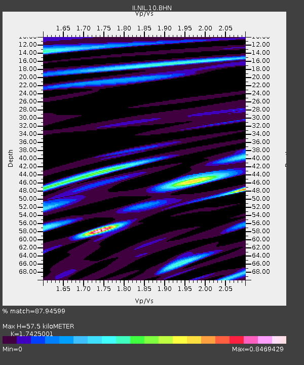
| Arrivals | |
| Ps | 7.2 SECOND |
| PpPs | 24 SECOND |
| PsPs/PpSs | 31 SECOND |

