NIL Nilore, Pakistan - Earthquake Result Viewer
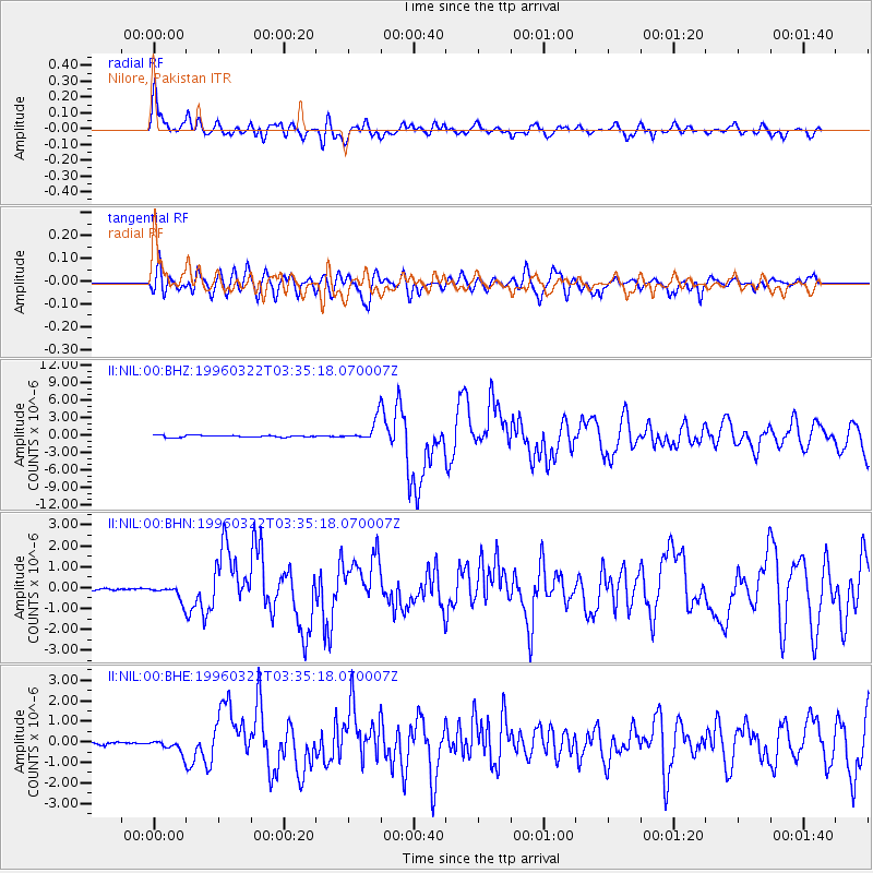
Earthquake location: Rat Islands, Aleutian Islands
Earthquake latitude/longitude: 51.2/178.7
Earthquake time(UTC): 1996/03/22 (082) 03:24:20 GMT
Earthquake Depth: 20 km
Earthquake Magnitude: 5.7 MB, 6.6 MS, 6.8 UNKNOWN, 6.6 ML
Earthquake Catalog/Contributor: WHDF/NEIC
Network: II Global Seismograph Network (GSN - IRIS/IDA)
Station: NIL Nilore, Pakistan
Lat/Lon: 33.65 N/73.27 E
Elevation: 629 m
Distance: 73.2 deg
Az: 302.859 deg
Baz: 39.294 deg
Ray Param: 0.053151887
Estimated Moho Depth: 40.5 km
Estimated Crust Vp/Vs: 2.04
Assumed Crust Vp: 6.242 km/s
Estimated Crust Vs: 3.06 km/s
Estimated Crust Poisson's Ratio: 0.34
Radial Match: 88.879776 %
Radial Bump: 400
Transverse Match: 83.13458 %
Transverse Bump: 400
SOD ConfigId: 6273
Insert Time: 2010-03-02 00:26:12.609 +0000
GWidth: 2.5
Max Bumps: 400
Tol: 0.001

Signal To Noise

ChannelStoNSTALTA
II:NIL:00:BHN:19960322T03:35:18.070007Z6.3433263.6581736E-75.766964E-8
II:NIL:00:BHE:19960322T03:35:18.070007Z2.48667073.329216E-71.3388247E-7
II:NIL:00:BHZ:19960322T03:35:18.070007Z10.982841.8318048E-61.6678791E-7
Arrivals
Ps6.9 SECOND
PpPs19 SECOND
PsPs/PpSs26 SECOND