NIL Nilore, Pakistan - Earthquake Result Viewer
Earthquake location: Eastern New Guinea Reg., P.N.G.
Earthquake latitude/longitude: -6.5/147.4
Earthquake time(UTC): 1997/04/05 (095) 12:23:30 GMT
Earthquake Depth: 69 km
Earthquake Magnitude: 6.1 MB, 6.5 UNKNOWN, 6.4 MW
Earthquake Catalog/Contributor: WHDF/NEIC
Network: II Global Seismograph Network (GSN - IRIS/IDA)
Station: NIL Nilore, Pakistan
Lat/Lon: 33.65 N/73.27 E
Elevation: 629 m
Distance: 80.5 deg
Az: 305.562 deg
Baz: 104.285 deg
Ray Param: 0.048081912
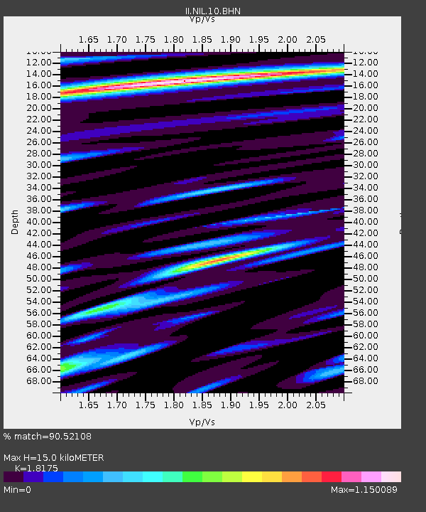
Estimated Moho Depth: 15.0 km
Estimated Crust Vp/Vs: 1.82
Assumed Crust Vp: 6.242 km/s
Estimated Crust Vs: 3.434 km/s
Estimated Crust Poisson's Ratio: 0.28
Radial Match: 90.52108 %
Radial Bump: 400
Transverse Match: 84.52532 %
Transverse Bump: 400
SOD ConfigId: 6273
Insert Time: 2010-03-02 00:26:24.818 +0000
GWidth: 2.5
Max Bumps: 400
Tol: 0.001

Signal To Noise

ChannelStoNSTALTA
II:NIL:10:BHN:19970405T12:35:04.114014Z0.75456448.6544205E-81.1469427E-7
II:NIL:10:BHE:19970405T12:35:04.114014Z1.77645862.0548502E-71.15671156E-7
II:NIL:10:BHZ:19970405T12:35:04.114014Z22.1574951.2571595E-65.6737438E-8
Arrivals
Ps2.0 SECOND
PpPs6.6 SECOND
PsPs/PpSs8.6 SECOND