You are here: Home > Network List > II - Global Seismograph Network (GSN - IRIS/IDA) Stations List
> Station NIL Nilore, Pakistan > Earthquake Result Viewer
NIL Nilore, Pakistan - Earthquake Result Viewer

| Earthquake location: |
Mariana Islands |
| Earthquake latitude/longitude: |
14.0/144.9 |
| Earthquake time(UTC): |
1997/04/23 (113) 19:44:28 GMT |
| Earthquake Depth: |
101 km |
| Earthquake Magnitude: |
6.2 MB, 6.5 UNKNOWN, 6.5 MW |
| Earthquake Catalog/Contributor: |
WHDF/NEIC |
|
| Network: |
II Global Seismograph Network (GSN - IRIS/IDA) |
| Station: |
NIL Nilore, Pakistan |
| Lat/Lon: |
33.65 N/73.27 E |
| Elevation: |
629 m |
|
| Distance: |
67.2 deg |
| Az: |
300.819 deg |
| Baz: |
88.035 deg |
| Ray Param: |
0.056855872 |
| Estimated Moho Depth: |
43.5 km |
| Estimated Crust Vp/Vs: |
2.00 |
| Assumed Crust Vp: |
6.242 km/s |
| Estimated Crust Vs: |
3.117 km/s |
| Estimated Crust Poisson's Ratio: |
0.33 |
|
| Radial Match: |
90.713196 % |
| Radial Bump: |
400 |
| Transverse Match: |
90.701775 % |
| Transverse Bump: |
400 |
| SOD ConfigId: |
6273 |
| Insert Time: |
2010-03-02 00:26:26.440 +0000 |
| GWidth: |
2.5 |
| Max Bumps: |
400 |
| Tol: |
0.001 |
|
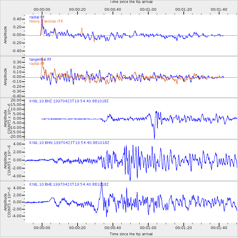
Signal To Noise
| Channel | StoN | STA | LTA |
| II:NIL:10:BHN:19970423T19:54:40.881018Z | 1.6557753 | 2.5131766E-7 | 1.5178246E-7 |
| II:NIL:10:BHE:19970423T19:54:40.881018Z | 2.3569553 | 4.7486273E-7 | 2.0147294E-7 |
| II:NIL:10:BHZ:19970423T19:54:40.881018Z | 7.6986337 | 6.7853784E-7 | 8.813744E-8 |
| Arrivals |
| Ps | 7.2 SECOND |
| PpPs | 20 SECOND |
| PsPs/PpSs | 27 SECOND |


