
NIL Nilore, Pakistan - Earthquake Result Viewer
| ||||||||||||||||||
| ||||||||||||||||||
| ||||||||||||||||||
|
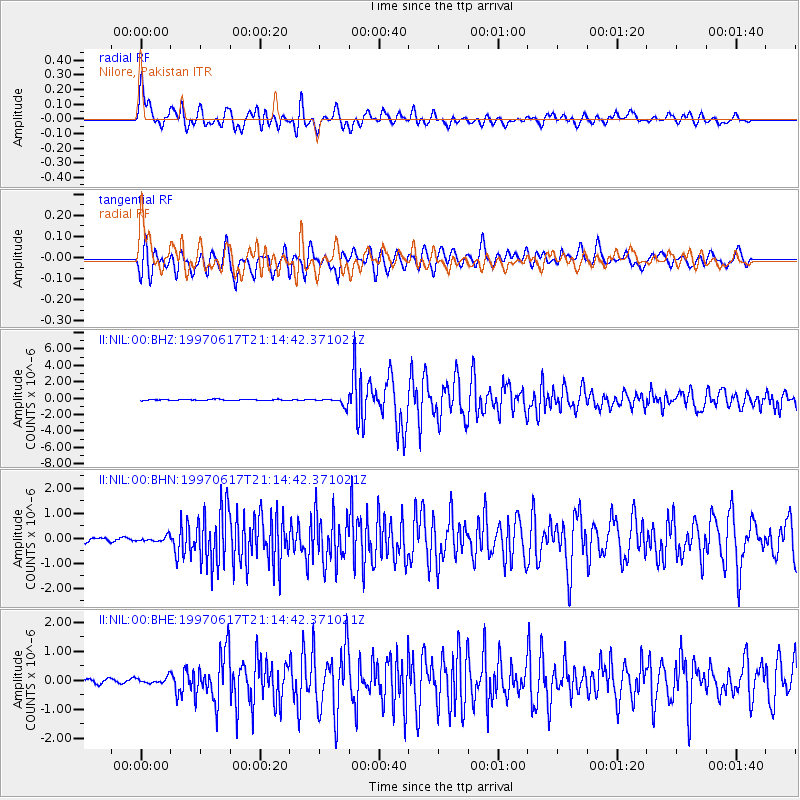
Signal To Noise
| Channel | StoN | STA | LTA |
| II:NIL:00:BHN:19970617T21:14:42.371021Z | 1.34876 | 1.0119414E-7 | 7.5027536E-8 |
| II:NIL:00:BHE:19970617T21:14:42.371021Z | 1.1152462 | 1.0781408E-7 | 9.66729E-8 |
| II:NIL:00:BHZ:19970617T21:14:42.371021Z | 7.130179 | 4.6142887E-7 | 6.4714904E-8 |
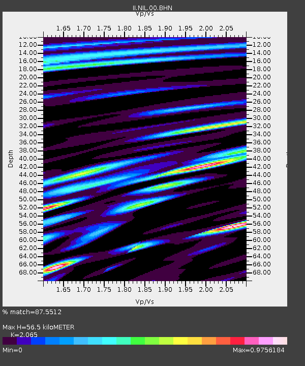
| Arrivals | |
| Ps | 9.9 SECOND |
| PpPs | 27 SECOND |
| PsPs/PpSs | 37 SECOND |

