NIL Nilore, Pakistan - Earthquake Result Viewer
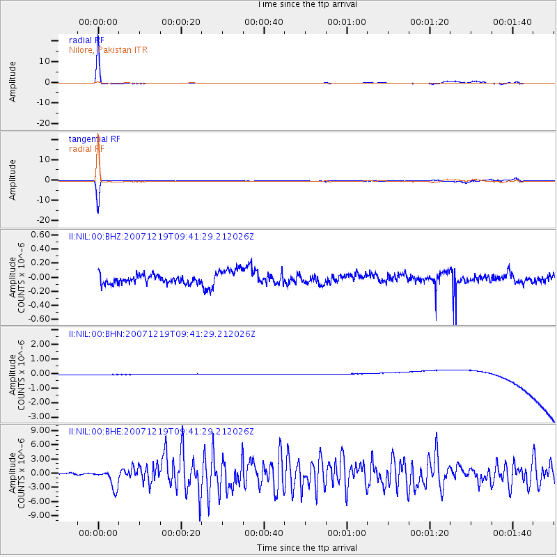
Earthquake location: Andreanof Islands, Aleutian Is.
Earthquake latitude/longitude: 51.4/-179.5
Earthquake time(UTC): 2007/12/19 (353) 09:30:27 GMT
Earthquake Depth: 29 km
Earthquake Magnitude: 6.4 MB, 7.1 MS, 7.1 MW, 7.0 MW
Earthquake Catalog/Contributor: WHDF/NEIC
Network: II Global Seismograph Network (GSN - IRIS/IDA)
Station: NIL Nilore, Pakistan
Lat/Lon: 33.65 N/73.27 E
Elevation: 629 m
Distance: 74.0 deg
Az: 304.03 deg
Baz: 38.527 deg
Ray Param: 0.052560862
Estimated Moho Depth: 69.75 km
Estimated Crust Vp/Vs: 1.64
Assumed Crust Vp: 6.242 km/s
Estimated Crust Vs: 3.806 km/s
Estimated Crust Poisson's Ratio: 0.20
Radial Match: 95.341866 %
Radial Bump: 99
Transverse Match: 88.027145 %
Transverse Bump: 117
SOD ConfigId: 2564
Insert Time: 2010-03-02 00:27:07.610 +0000
GWidth: 2.5
Max Bumps: 400
Tol: 0.001

Signal To Noise

ChannelStoNSTALTA
II:NIL:00:BHN:20071219T09:41:29.212026Z0.915946542.4548248E-72.6800961E-7
II:NIL:00:BHE:20071219T09:41:29.212026Z18.175412.0811144E-61.1450165E-7
II:NIL:00:BHZ:20071219T09:41:29.212026Z2.5786881.4630275E-75.6735345E-8
Arrivals
Ps7.4 SECOND
PpPs29 SECOND
PsPs/PpSs36 SECOND