You are here: Home > Network List > II - Global Seismograph Network (GSN - IRIS/IDA) Stations List
> Station NIL Nilore, Pakistan > Earthquake Result Viewer
NIL Nilore, Pakistan - Earthquake Result Viewer

| Earthquake location: |
Kuril Islands |
| Earthquake latitude/longitude: |
45.9/151.3 |
| Earthquake time(UTC): |
1995/04/17 (107) 23:28:08 GMT |
| Earthquake Depth: |
34 km |
| Earthquake Magnitude: |
6.1 MB, 6.3 MS, 6.2 UNKNOWN, 6.8 MW |
| Earthquake Catalog/Contributor: |
WHDF/NEIC |
|
| Network: |
II Global Seismograph Network (GSN - IRIS/IDA) |
| Station: |
NIL Nilore, Pakistan |
| Lat/Lon: |
33.65 N/73.27 E |
| Elevation: |
629 m |
|
| Distance: |
59.0 deg |
| Az: |
287.749 deg |
| Baz: |
52.87 deg |
| Ray Param: |
0.06244804 |
| Estimated Moho Depth: |
47.5 km |
| Estimated Crust Vp/Vs: |
1.92 |
| Assumed Crust Vp: |
6.242 km/s |
| Estimated Crust Vs: |
3.243 km/s |
| Estimated Crust Poisson's Ratio: |
0.32 |
|
| Radial Match: |
91.66738 % |
| Radial Bump: |
400 |
| Transverse Match: |
85.455154 % |
| Transverse Bump: |
400 |
| SOD ConfigId: |
4480 |
| Insert Time: |
2010-03-02 00:27:19.942 +0000 |
| GWidth: |
2.5 |
| Max Bumps: |
400 |
| Tol: |
0.001 |
|
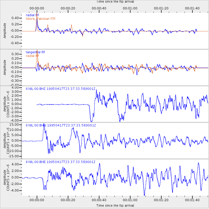
Signal To Noise
| Channel | StoN | STA | LTA |
| II:NIL:00:BHN:19950417T23:37:33.589001Z | 69.188416 | 5.73678E-6 | 8.291533E-8 |
| II:NIL:00:BHE:19950417T23:37:33.589001Z | 14.515731 | 1.2125702E-6 | 8.353491E-8 |
| II:NIL:00:BHZ:19950417T23:37:33.589001Z | 24.786734 | 1.2641382E-6 | 5.1000598E-8 |
| Arrivals |
| Ps | 7.3 SECOND |
| PpPs | 21 SECOND |
| PsPs/PpSs | 29 SECOND |


