You are here: Home > Network List > TA - USArray Transportable Network (new EarthScope stations) Stations List
> Station I23K Minto, Yukon-Koyukuk, AK, USA > Earthquake Result Viewer
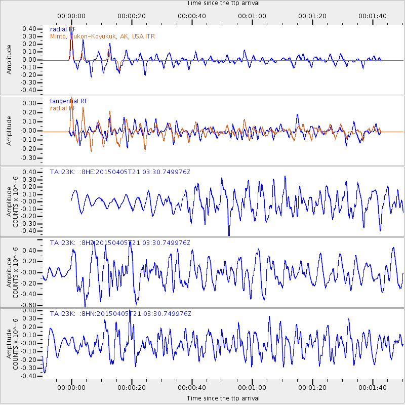
I23K Minto, Yukon-Koyukuk, AK, USA - Earthquake Result Viewer
*The percent match for this event was below the threshold and hence no stack was calculated.
| Earthquake location: |
New Britain Region, P.N.G. |
| Earthquake latitude/longitude: |
-5.6/152.7 |
| Earthquake time(UTC): |
2015/04/05 (095) 20:51:44 GMT |
| Earthquake Depth: |
38 km |
| Earthquake Magnitude: |
5.5 MW |
| Earthquake Catalog/Contributor: |
ISC/ISC |
|
| Network: |
TA USArray Transportable Network (new EarthScope stations) |
| Station: |
I23K Minto, Yukon-Koyukuk, AK, USA |
| Lat/Lon: |
65.15 N/149.36 W |
| Elevation: |
149 m |
|
| Distance: |
82.2 deg |
| Az: |
21.195 deg |
| Baz: |
238.378 deg |
| Ray Param: |
$rayparam |
*The percent match for this event was below the threshold and hence was not used in the summary stack. |
|
| Radial Match: |
65.354996 % |
| Radial Bump: |
400 |
| Transverse Match: |
46.6854 % |
| Transverse Bump: |
400 |
| SOD ConfigId: |
7422571 |
| Insert Time: |
2019-04-18 02:51:54.605 +0000 |
| GWidth: |
2.5 |
| Max Bumps: |
400 |
| Tol: |
0.001 |
|
Signal To Noise
| Channel | StoN | STA | LTA |
| TA:I23K: :BHZ:20150405T21:03:30.749976Z | 4.630048 | 3.1437315E-7 | 6.7898476E-8 |
| TA:I23K: :BHN:20150405T21:03:30.749976Z | 0.36060268 | 6.1455154E-8 | 1.7042345E-7 |
| TA:I23K: :BHE:20150405T21:03:30.749976Z | 1.1163046 | 7.875934E-8 | 7.0553625E-8 |
| Arrivals |
| Ps | |
| PpPs | |
| PsPs/PpSs | |


