You are here: Home > Network List > TA - USArray Transportable Network (new EarthScope stations) Stations List
> Station T57A Hurt, VA, USA > Earthquake Result Viewer
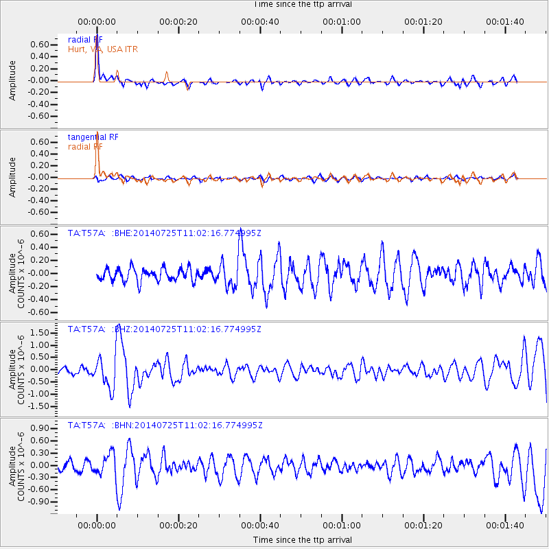
T57A Hurt, VA, USA - Earthquake Result Viewer
*The percent match for this event was below the threshold and hence no stack was calculated.
| Earthquake location: |
Southeastern Alaska |
| Earthquake latitude/longitude: |
58.4/-137.1 |
| Earthquake time(UTC): |
2014/07/25 (206) 10:54:49 GMT |
| Earthquake Depth: |
10 km |
| Earthquake Magnitude: |
5.9 MWP |
| Earthquake Catalog/Contributor: |
NEIC PDE/NEIC COMCAT |
|
| Network: |
TA USArray Transportable Network (new EarthScope stations) |
| Station: |
T57A Hurt, VA, USA |
| Lat/Lon: |
37.00 N/79.25 W |
| Elevation: |
230 m |
|
| Distance: |
42.8 deg |
| Az: |
93.87 deg |
| Baz: |
318.931 deg |
| Ray Param: |
$rayparam |
*The percent match for this event was below the threshold and hence was not used in the summary stack. |
|
| Radial Match: |
73.84927 % |
| Radial Bump: |
262 |
| Transverse Match: |
42.495865 % |
| Transverse Bump: |
400 |
| SOD ConfigId: |
769524 |
| Insert Time: |
2014-08-08 12:00:11.258 +0000 |
| GWidth: |
2.5 |
| Max Bumps: |
400 |
| Tol: |
0.001 |
|
Signal To Noise
| Channel | StoN | STA | LTA |
| TA:T57A: :BHZ:20140725T11:02:16.774995Z | 4.6502004 | 6.6581845E-7 | 1.431806E-7 |
| TA:T57A: :BHN:20140725T11:02:16.774995Z | 2.4715483 | 2.709482E-7 | 1.0962691E-7 |
| TA:T57A: :BHE:20140725T11:02:16.774995Z | 2.0017965 | 1.9149404E-7 | 9.5661086E-8 |
| Arrivals |
| Ps | |
| PpPs | |
| PsPs/PpSs | |


