You are here: Home > Network List > TA - USArray Transportable Network (new EarthScope stations) Stations List
> Station X43A Marvell, AR, USA > Earthquake Result Viewer
X43A Marvell, AR, USA - Earthquake Result Viewer
*The percent match for this event was below the threshold and hence no stack was calculated.
| Earthquake location: |
Southeastern Alaska |
| Earthquake latitude/longitude: |
58.4/-137.1 |
| Earthquake time(UTC): |
2014/07/25 (206) 10:54:49 GMT |
| Earthquake Depth: |
10 km |
| Earthquake Magnitude: |
5.9 MWP |
| Earthquake Catalog/Contributor: |
NEIC PDE/NEIC COMCAT |
|
| Network: |
TA USArray Transportable Network (new EarthScope stations) |
| Station: |
X43A Marvell, AR, USA |
| Lat/Lon: |
34.52 N/90.88 W |
| Elevation: |
53 m |
|
| Distance: |
38.7 deg |
| Az: |
107.482 deg |
| Baz: |
322.487 deg |
| Ray Param: |
$rayparam |
*The percent match for this event was below the threshold and hence was not used in the summary stack. |
|
| Radial Match: |
60.19416 % |
| Radial Bump: |
372 |
| Transverse Match: |
60.842487 % |
| Transverse Bump: |
400 |
| SOD ConfigId: |
769524 |
| Insert Time: |
2014-08-08 12:02:31.881 +0000 |
| GWidth: |
2.5 |
| Max Bumps: |
400 |
| Tol: |
0.001 |
|
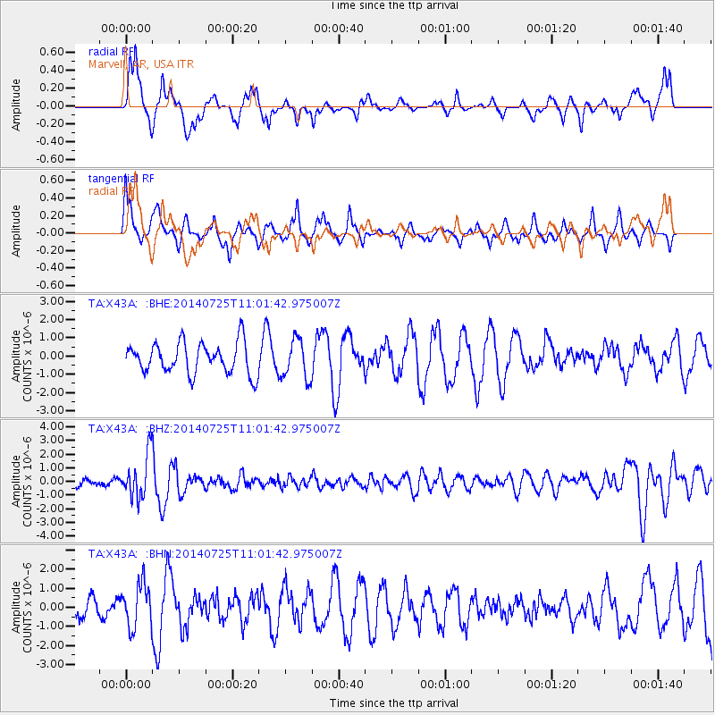
Signal To Noise
| Channel | StoN | STA | LTA |
| TA:X43A: :BHZ:20140725T11:01:42.975007Z | 5.700775 | 1.6191701E-6 | 2.840263E-7 |
| TA:X43A: :BHN:20140725T11:01:42.975007Z | 1.1232235 | 1.1364693E-6 | 1.0117926E-6 |
| TA:X43A: :BHE:20140725T11:01:42.975007Z | 1.2725098 | 1.088474E-6 | 8.553757E-7 |
| Arrivals |
| Ps | |
| PpPs | |
| PsPs/PpSs | |


