You are here: Home > Network List > TA - USArray Transportable Network (new EarthScope stations) Stations List
> Station Y58A Scranton, SC, USA > Earthquake Result Viewer
Y58A Scranton, SC, USA - Earthquake Result Viewer

| Earthquake location: |
Southeastern Alaska |
| Earthquake latitude/longitude: |
58.4/-137.1 |
| Earthquake time(UTC): |
2014/07/25 (206) 10:54:49 GMT |
| Earthquake Depth: |
10 km |
| Earthquake Magnitude: |
5.9 MWP |
| Earthquake Catalog/Contributor: |
NEIC PDE/NEIC COMCAT |
|
| Network: |
TA USArray Transportable Network (new EarthScope stations) |
| Station: |
Y58A Scranton, SC, USA |
| Lat/Lon: |
33.91 N/79.67 W |
| Elevation: |
19 m |
|
| Distance: |
45.0 deg |
| Az: |
97.105 deg |
| Baz: |
321.025 deg |
| Ray Param: |
0.07159549 |
| Estimated Moho Depth: |
28.75 km |
| Estimated Crust Vp/Vs: |
2.00 |
| Assumed Crust Vp: |
6.24 km/s |
| Estimated Crust Vs: |
3.124 km/s |
| Estimated Crust Poisson's Ratio: |
0.33 |
|
| Radial Match: |
95.37227 % |
| Radial Bump: |
207 |
| Transverse Match: |
54.593952 % |
| Transverse Bump: |
400 |
| SOD ConfigId: |
769524 |
| Insert Time: |
2014-08-08 12:03:27.260 +0000 |
| GWidth: |
2.5 |
| Max Bumps: |
400 |
| Tol: |
0.001 |
|
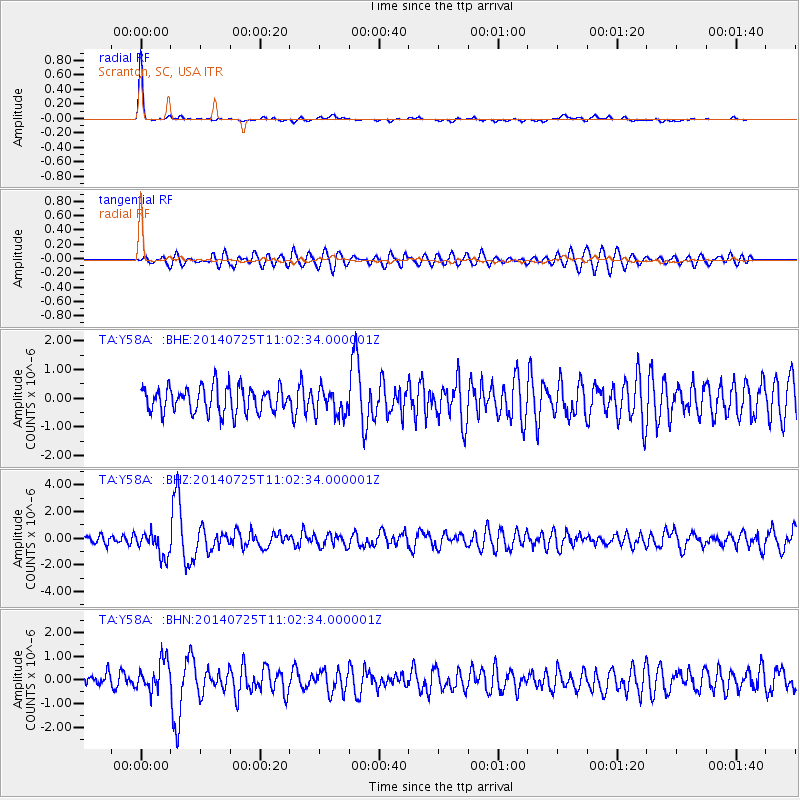
Signal To Noise
| Channel | StoN | STA | LTA |
| TA:Y58A: :BHZ:20140725T11:02:34.000001Z | 2.4156022 | 9.3330414E-7 | 3.86365E-7 |
| TA:Y58A: :BHN:20140725T11:02:34.000001Z | 1.7944206 | 6.3012396E-7 | 3.5115733E-7 |
| TA:Y58A: :BHE:20140725T11:02:34.000001Z | 1.0322691 | 4.598432E-7 | 4.4546832E-7 |
| Arrivals |
| Ps | 4.8 SECOND |
| PpPs | 13 SECOND |
| PsPs/PpSs | 18 SECOND |


