You are here: Home > Network List > US - United States National Seismic Network Stations List
> Station AAM Ann Arbor, Michigan, USA > Earthquake Result Viewer
AAM Ann Arbor, Michigan, USA - Earthquake Result Viewer

| Earthquake location: |
Southeastern Alaska |
| Earthquake latitude/longitude: |
58.4/-137.1 |
| Earthquake time(UTC): |
2014/07/25 (206) 10:54:49 GMT |
| Earthquake Depth: |
10 km |
| Earthquake Magnitude: |
5.9 MWP |
| Earthquake Catalog/Contributor: |
NEIC PDE/NEIC COMCAT |
|
| Network: |
US United States National Seismic Network |
| Station: |
AAM Ann Arbor, Michigan, USA |
| Lat/Lon: |
42.30 N/83.66 W |
| Elevation: |
172 m |
|
| Distance: |
36.6 deg |
| Az: |
92.087 deg |
| Baz: |
314.755 deg |
| Ray Param: |
0.07658005 |
| Estimated Moho Depth: |
39.5 km |
| Estimated Crust Vp/Vs: |
1.64 |
| Assumed Crust Vp: |
6.483 km/s |
| Estimated Crust Vs: |
3.947 km/s |
| Estimated Crust Poisson's Ratio: |
0.21 |
|
| Radial Match: |
92.51797 % |
| Radial Bump: |
260 |
| Transverse Match: |
76.48871 % |
| Transverse Bump: |
394 |
| SOD ConfigId: |
769524 |
| Insert Time: |
2014-08-08 12:05:08.059 +0000 |
| GWidth: |
2.5 |
| Max Bumps: |
400 |
| Tol: |
0.001 |
|
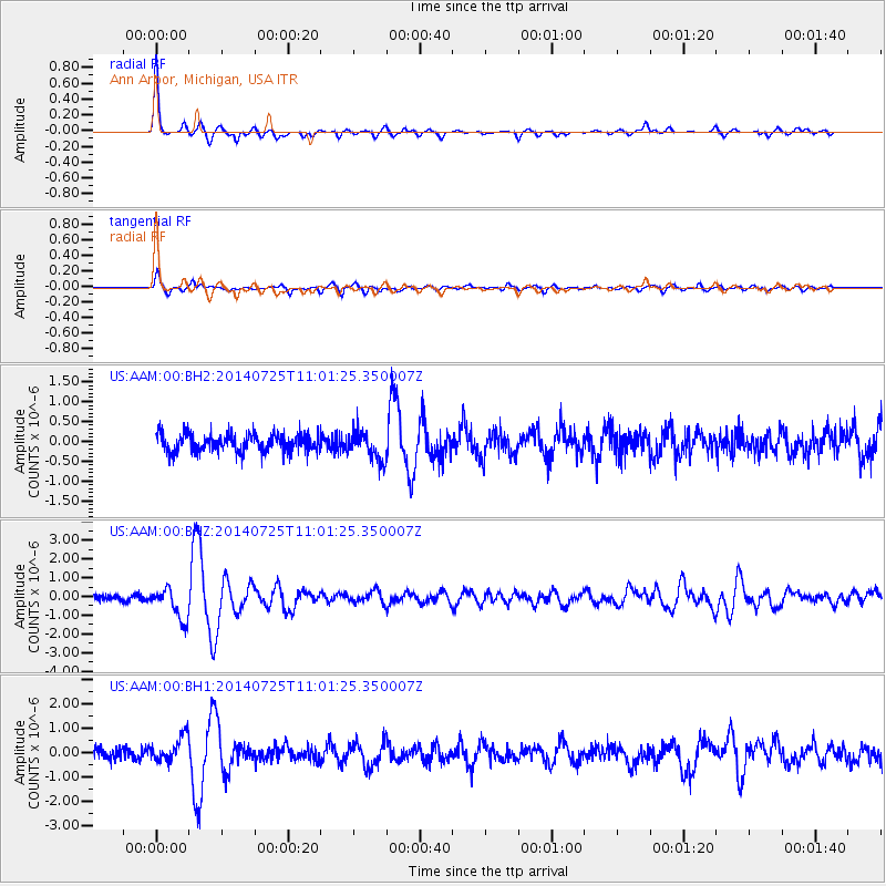
Signal To Noise
| Channel | StoN | STA | LTA |
| US:AAM:00:BHZ:20140725T11:01:25.350007Z | 4.7953577 | 8.3749956E-7 | 1.7464798E-7 |
| US:AAM:00:BH1:20140725T11:01:25.350007Z | 2.7723777 | 5.298787E-7 | 1.9112788E-7 |
| US:AAM:00:BH2:20140725T11:01:25.350007Z | 1.5702434 | 3.592165E-7 | 2.2876486E-7 |
| Arrivals |
| Ps | 4.3 SECOND |
| PpPs | 15 SECOND |
| PsPs/PpSs | 19 SECOND |


