You are here: Home > Network List > US - United States National Seismic Network Stations List
> Station GLMI Grayling, Michigan, USA > Earthquake Result Viewer
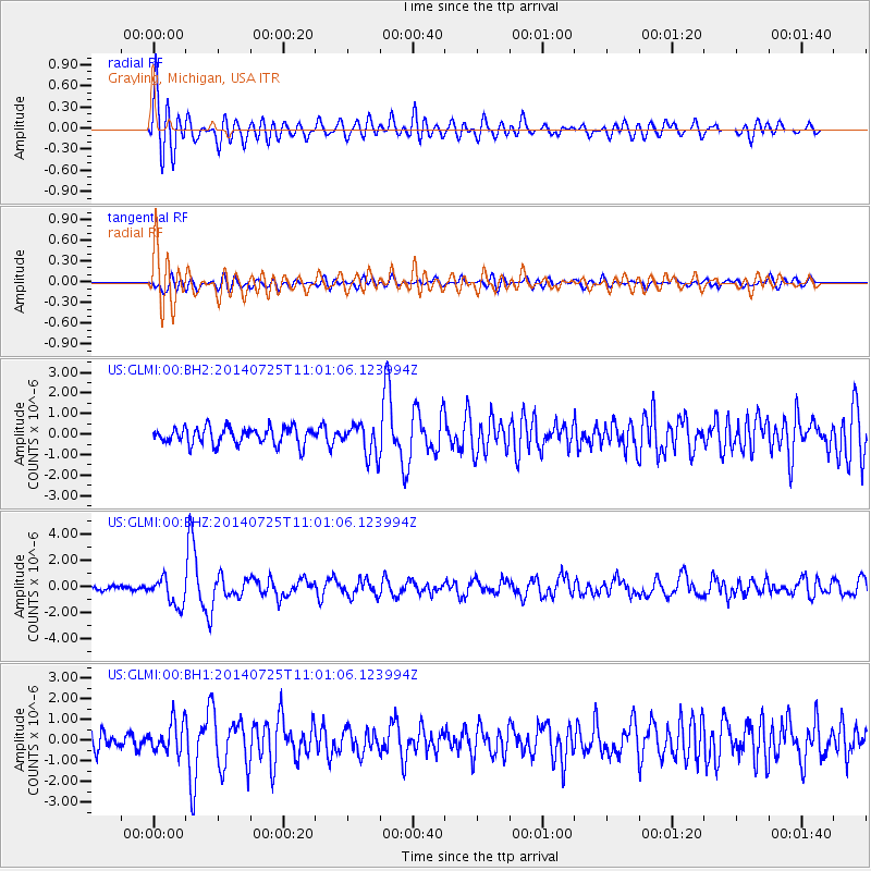
GLMI Grayling, Michigan, USA - Earthquake Result Viewer
*The percent match for this event was below the threshold and hence no stack was calculated.
| Earthquake location: |
Southeastern Alaska |
| Earthquake latitude/longitude: |
58.4/-137.1 |
| Earthquake time(UTC): |
2014/07/25 (206) 10:54:49 GMT |
| Earthquake Depth: |
10 km |
| Earthquake Magnitude: |
5.9 MWP |
| Earthquake Catalog/Contributor: |
NEIC PDE/NEIC COMCAT |
|
| Network: |
US United States National Seismic Network |
| Station: |
GLMI Grayling, Michigan, USA |
| Lat/Lon: |
44.82 N/84.62 W |
| Elevation: |
387 m |
|
| Distance: |
34.4 deg |
| Az: |
89.763 deg |
| Baz: |
312.202 deg |
| Ray Param: |
$rayparam |
*The percent match for this event was below the threshold and hence was not used in the summary stack. |
|
| Radial Match: |
78.06126 % |
| Radial Bump: |
400 |
| Transverse Match: |
64.71637 % |
| Transverse Bump: |
400 |
| SOD ConfigId: |
769524 |
| Insert Time: |
2014-08-08 12:05:44.418 +0000 |
| GWidth: |
2.5 |
| Max Bumps: |
400 |
| Tol: |
0.001 |
|
Signal To Noise
| Channel | StoN | STA | LTA |
| US:GLMI:00:BHZ:20140725T11:01:06.123994Z | 7.235956 | 1.0563305E-6 | 1.4598353E-7 |
| US:GLMI:00:BH1:20140725T11:01:06.123994Z | 2.1679075 | 7.376666E-7 | 3.4026667E-7 |
| US:GLMI:00:BH2:20140725T11:01:06.123994Z | 1.8532485 | 7.75298E-7 | 4.1834542E-7 |
| Arrivals |
| Ps | |
| PpPs | |
| PsPs/PpSs | |


