You are here: Home > Network List > II - Global Seismograph Network (GSN - IRIS/IDA) Stations List
> Station NIL Nilore, Pakistan > Earthquake Result Viewer
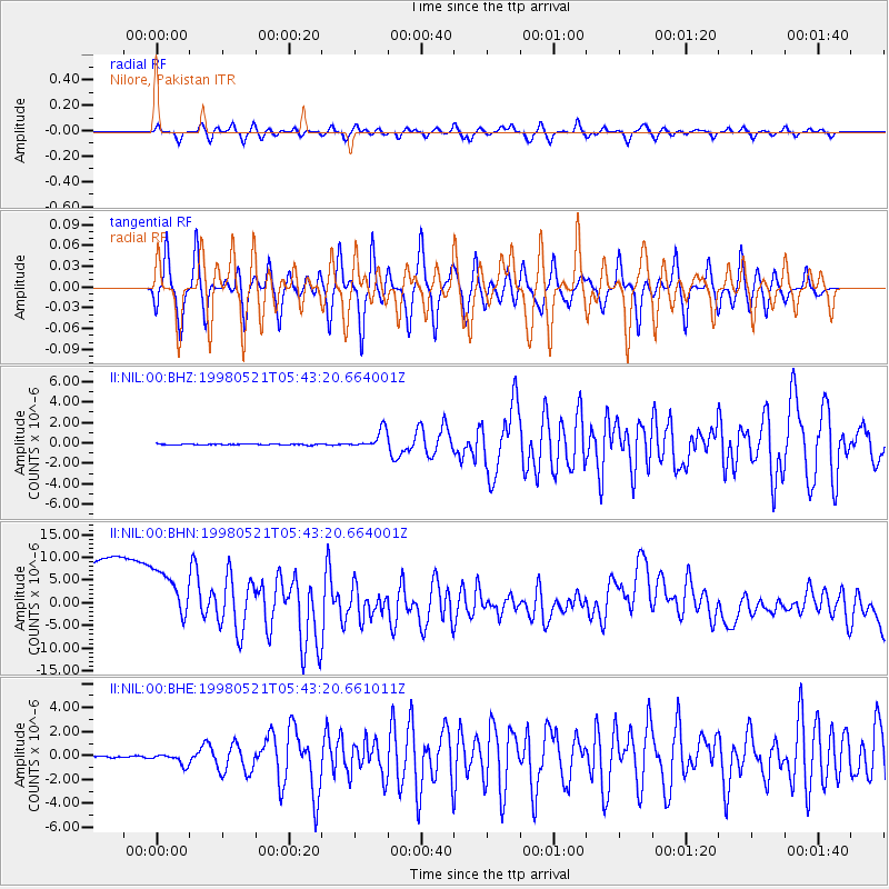
NIL Nilore, Pakistan - Earthquake Result Viewer
*The percent match for this event was below the threshold and hence no stack was calculated.
| Earthquake location: |
Minahassa Peninsula, Sulawesi |
| Earthquake latitude/longitude: |
0.2/119.6 |
| Earthquake time(UTC): |
1998/05/21 (141) 05:34:25 GMT |
| Earthquake Depth: |
33 km |
| Earthquake Magnitude: |
6.2 MB, 6.3 MS, 6.6 UNKNOWN, 6.6 MW |
| Earthquake Catalog/Contributor: |
WHDF/NEIC |
|
| Network: |
II Global Seismograph Network (GSN - IRIS/IDA) |
| Station: |
NIL Nilore, Pakistan |
| Lat/Lon: |
33.65 N/73.27 E |
| Elevation: |
629 m |
|
| Distance: |
54.7 deg |
| Az: |
312.331 deg |
| Baz: |
117.594 deg |
| Ray Param: |
$rayparam |
*The percent match for this event was below the threshold and hence was not used in the summary stack. |
|
| Radial Match: |
67.89256 % |
| Radial Bump: |
400 |
| Transverse Match: |
73.34264 % |
| Transverse Bump: |
400 |
| SOD ConfigId: |
4480 |
| Insert Time: |
2010-03-02 00:28:51.763 +0000 |
| GWidth: |
2.5 |
| Max Bumps: |
400 |
| Tol: |
0.001 |
|
Signal To Noise
| Channel | StoN | STA | LTA |
| II:NIL:00:BHN:19980521T05:43:20.664001Z | 0.9270307 | 1.5904094E-5 | 1.7155951E-5 |
| II:NIL:00:BHE:19980521T05:43:20.661011Z | 8.048748 | 4.6761116E-7 | 5.809738E-8 |
| II:NIL:00:BHZ:19980521T05:43:20.664001Z | 18.726028 | 9.2002057E-7 | 4.9130577E-8 |
| Arrivals |
| Ps | |
| PpPs | |
| PsPs/PpSs | |


