You are here: Home > Network List > II - Global Seismograph Network (GSN - IRIS/IDA) Stations List
> Station NIL Nilore, Pakistan > Earthquake Result Viewer
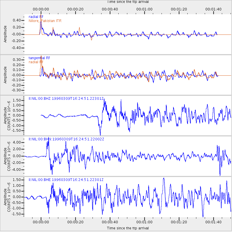
NIL Nilore, Pakistan - Earthquake Result Viewer
*The percent match for this event was below the threshold and hence no stack was calculated.
| Earthquake location: |
East Of Kuril Islands |
| Earthquake latitude/longitude: |
43.4/148.0 |
| Earthquake time(UTC): |
1996/03/09 (069) 16:15:36 GMT |
| Earthquake Depth: |
33 km |
| Earthquake Magnitude: |
5.6 MB, 5.9 MS, 6.1 UNKNOWN, 5.5 MS |
| Earthquake Catalog/Contributor: |
WHDF/NEIC |
|
| Network: |
II Global Seismograph Network (GSN - IRIS/IDA) |
| Station: |
NIL Nilore, Pakistan |
| Lat/Lon: |
33.65 N/73.27 E |
| Elevation: |
629 m |
|
| Distance: |
57.5 deg |
| Az: |
287.353 deg |
| Baz: |
56.479 deg |
| Ray Param: |
$rayparam |
*The percent match for this event was below the threshold and hence was not used in the summary stack. |
|
| Radial Match: |
75.17536 % |
| Radial Bump: |
400 |
| Transverse Match: |
68.65128 % |
| Transverse Bump: |
400 |
| SOD ConfigId: |
4480 |
| Insert Time: |
2010-03-02 00:29:12.075 +0000 |
| GWidth: |
2.5 |
| Max Bumps: |
400 |
| Tol: |
0.001 |
|
Signal To Noise
| Channel | StoN | STA | LTA |
| II:NIL:00:BHN:19960309T16:24:51.22002Z | 16.966888 | 1.8951494E-6 | 1.1169693E-7 |
| II:NIL:00:BHE:19960309T16:24:51.22301Z | 5.1887603 | 3.785251E-7 | 7.295097E-8 |
| II:NIL:00:BHZ:19960309T16:24:51.22301Z | 7.9587398 | 6.5960666E-7 | 8.287827E-8 |
| Arrivals |
| Ps | |
| PpPs | |
| PsPs/PpSs | |


