You are here: Home > Network List > II - Global Seismograph Network (GSN - IRIS/IDA) Stations List
> Station NIL Nilore, Pakistan > Earthquake Result Viewer
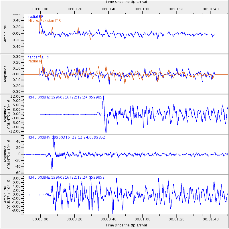
NIL Nilore, Pakistan - Earthquake Result Viewer
*The percent match for this event was below the threshold and hence no stack was calculated.
| Earthquake location: |
Bonin Islands, Japan Region |
| Earthquake latitude/longitude: |
29.0/138.9 |
| Earthquake time(UTC): |
1996/03/16 (076) 22:04:06 GMT |
| Earthquake Depth: |
477 km |
| Earthquake Magnitude: |
5.9 MB, 6.6 UNKNOWN, 6.1 MB |
| Earthquake Catalog/Contributor: |
WHDF/NEIC |
|
| Network: |
II Global Seismograph Network (GSN - IRIS/IDA) |
| Station: |
NIL Nilore, Pakistan |
| Lat/Lon: |
33.65 N/73.27 E |
| Elevation: |
629 m |
|
| Distance: |
55.5 deg |
| Az: |
292.677 deg |
| Baz: |
75.729 deg |
| Ray Param: |
$rayparam |
*The percent match for this event was below the threshold and hence was not used in the summary stack. |
|
| Radial Match: |
79.87846 % |
| Radial Bump: |
400 |
| Transverse Match: |
86.21894 % |
| Transverse Bump: |
400 |
| SOD ConfigId: |
4480 |
| Insert Time: |
2010-03-02 00:29:13.097 +0000 |
| GWidth: |
2.5 |
| Max Bumps: |
400 |
| Tol: |
0.001 |
|
Signal To Noise
| Channel | StoN | STA | LTA |
| II:NIL:00:BHN:19960316T22:12:24.059985Z | 14.836024 | 1.9026484E-6 | 1.2824516E-7 |
| II:NIL:00:BHE:19960316T22:12:24.059985Z | 3.2251172 | 2.2065424E-7 | 6.8417435E-8 |
| II:NIL:00:BHZ:19960316T22:12:24.059985Z | 5.597736 | 6.00286E-7 | 1.07237284E-7 |
| Arrivals |
| Ps | |
| PpPs | |
| PsPs/PpSs | |


