You are here: Home > Network List > II - Global Seismograph Network (GSN - IRIS/IDA) Stations List
> Station NIL Nilore, Pakistan > Earthquake Result Viewer
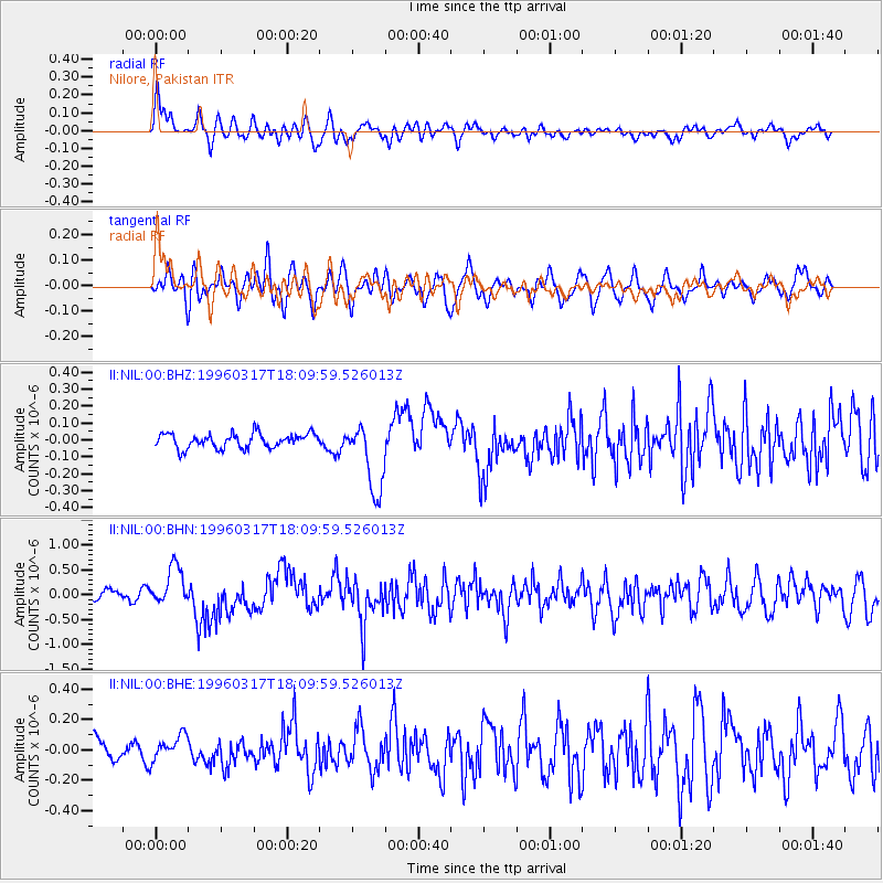
NIL Nilore, Pakistan - Earthquake Result Viewer
*The percent match for this event was below the threshold and hence no stack was calculated.
| Earthquake location: |
Eastern New Guinea Reg., P.N.G. |
| Earthquake latitude/longitude: |
-6.3/147.9 |
| Earthquake time(UTC): |
1996/03/17 (077) 17:58:20 GMT |
| Earthquake Depth: |
33 km |
| Earthquake Magnitude: |
5.5 MB, 6.0 MS, 6.1 UNKNOWN, 6.2 ML |
| Earthquake Catalog/Contributor: |
WHDF/NEIC |
|
| Network: |
II Global Seismograph Network (GSN - IRIS/IDA) |
| Station: |
NIL Nilore, Pakistan |
| Lat/Lon: |
33.65 N/73.27 E |
| Elevation: |
629 m |
|
| Distance: |
80.8 deg |
| Az: |
305.431 deg |
| Baz: |
103.818 deg |
| Ray Param: |
$rayparam |
*The percent match for this event was below the threshold and hence was not used in the summary stack. |
|
| Radial Match: |
73.00837 % |
| Radial Bump: |
400 |
| Transverse Match: |
63.68272 % |
| Transverse Bump: |
400 |
| SOD ConfigId: |
4480 |
| Insert Time: |
2010-03-02 00:29:15.051 +0000 |
| GWidth: |
2.5 |
| Max Bumps: |
400 |
| Tol: |
0.001 |
|
Signal To Noise
| Channel | StoN | STA | LTA |
| II:NIL:00:BHN:19960317T18:09:59.526013Z | 4.7190266 | 3.8704465E-7 | 8.2017905E-8 |
| II:NIL:00:BHE:19960317T18:09:59.526013Z | 0.69346565 | 8.3197996E-8 | 1.199742E-7 |
| II:NIL:00:BHZ:19960317T18:09:59.526013Z | 4.8285947 | 2.0588409E-7 | 4.263851E-8 |
| Arrivals |
| Ps | |
| PpPs | |
| PsPs/PpSs | |


