You are here: Home > Network List > II - Global Seismograph Network (GSN - IRIS/IDA) Stations List
> Station NIL Nilore, Pakistan > Earthquake Result Viewer
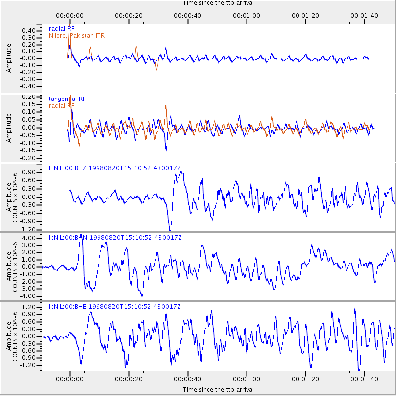
NIL Nilore, Pakistan - Earthquake Result Viewer
*The percent match for this event was below the threshold and hence no stack was calculated.
| Earthquake location: |
Rat Islands, Aleutian Islands |
| Earthquake latitude/longitude: |
51.6/175.2 |
| Earthquake time(UTC): |
1998/08/20 (232) 15:00:08 GMT |
| Earthquake Depth: |
33 km |
| Earthquake Magnitude: |
5.6 MB, 6.0 MS, 6.2 UNKNOWN, 6.2 MW |
| Earthquake Catalog/Contributor: |
WHDF/NEIC |
|
| Network: |
II Global Seismograph Network (GSN - IRIS/IDA) |
| Station: |
NIL Nilore, Pakistan |
| Lat/Lon: |
33.65 N/73.27 E |
| Elevation: |
629 m |
|
| Distance: |
71.1 deg |
| Az: |
300.426 deg |
| Baz: |
40.128 deg |
| Ray Param: |
$rayparam |
*The percent match for this event was below the threshold and hence was not used in the summary stack. |
|
| Radial Match: |
70.07789 % |
| Radial Bump: |
400 |
| Transverse Match: |
75.895355 % |
| Transverse Bump: |
400 |
| SOD ConfigId: |
4480 |
| Insert Time: |
2010-03-02 00:29:18.560 +0000 |
| GWidth: |
2.5 |
| Max Bumps: |
400 |
| Tol: |
0.001 |
|
Signal To Noise
| Channel | StoN | STA | LTA |
| II:NIL:00:BHN:19980820T15:10:52.430017Z | 3.2132006 | 1.8963685E-6 | 5.9018055E-7 |
| II:NIL:00:BHE:19980820T15:10:52.430017Z | 4.8788905 | 4.8150565E-7 | 9.869163E-8 |
| II:NIL:00:BHZ:19980820T15:10:52.430017Z | 4.463244 | 5.171263E-7 | 1.1586332E-7 |
| Arrivals |
| Ps | |
| PpPs | |
| PsPs/PpSs | |


