You are here: Home > Network List > II - Global Seismograph Network (GSN - IRIS/IDA) Stations List
> Station NIL Nilore, Pakistan > Earthquake Result Viewer
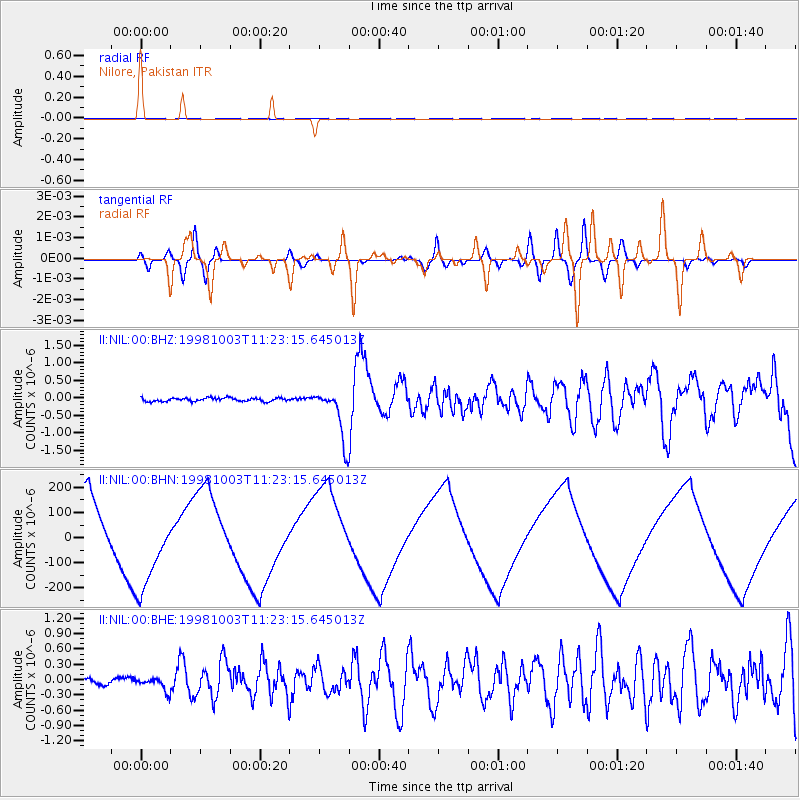
NIL Nilore, Pakistan - Earthquake Result Viewer
*The percent match for this event was below the threshold and hence no stack was calculated.
| Earthquake location: |
Northwest Of Ryukyu Islands |
| Earthquake latitude/longitude: |
28.5/127.6 |
| Earthquake time(UTC): |
1998/10/03 (276) 11:15:42 GMT |
| Earthquake Depth: |
227 km |
| Earthquake Magnitude: |
5.6 MB, 6.1 UNKNOWN, 6.1 MW |
| Earthquake Catalog/Contributor: |
WHDF/NEIC |
|
| Network: |
II Global Seismograph Network (GSN - IRIS/IDA) |
| Station: |
NIL Nilore, Pakistan |
| Lat/Lon: |
33.65 N/73.27 E |
| Elevation: |
629 m |
|
| Distance: |
46.4 deg |
| Az: |
290.587 deg |
| Baz: |
81.015 deg |
| Ray Param: |
$rayparam |
*The percent match for this event was below the threshold and hence was not used in the summary stack. |
|
| Radial Match: |
33.616493 % |
| Radial Bump: |
400 |
| Transverse Match: |
24.297117 % |
| Transverse Bump: |
400 |
| SOD ConfigId: |
4480 |
| Insert Time: |
2010-03-02 00:29:44.442 +0000 |
| GWidth: |
2.5 |
| Max Bumps: |
400 |
| Tol: |
0.001 |
|
Signal To Noise
| Channel | StoN | STA | LTA |
| II:NIL:00:BHN:19981003T11:23:15.645013Z | 1.2136481 | 1.7279366E-4 | 1.4237541E-4 |
| II:NIL:00:BHE:19981003T11:23:15.645013Z | 1.8885841 | 1.342734E-7 | 7.1097396E-8 |
| II:NIL:00:BHZ:19981003T11:23:15.645013Z | 15.026 | 7.397728E-7 | 4.9232852E-8 |
| Arrivals |
| Ps | |
| PpPs | |
| PsPs/PpSs | |


