You are here: Home > Network List > TA - USArray Transportable Network (new EarthScope stations) Stations List
> Station MDND Maddock, ND, USA > Earthquake Result Viewer
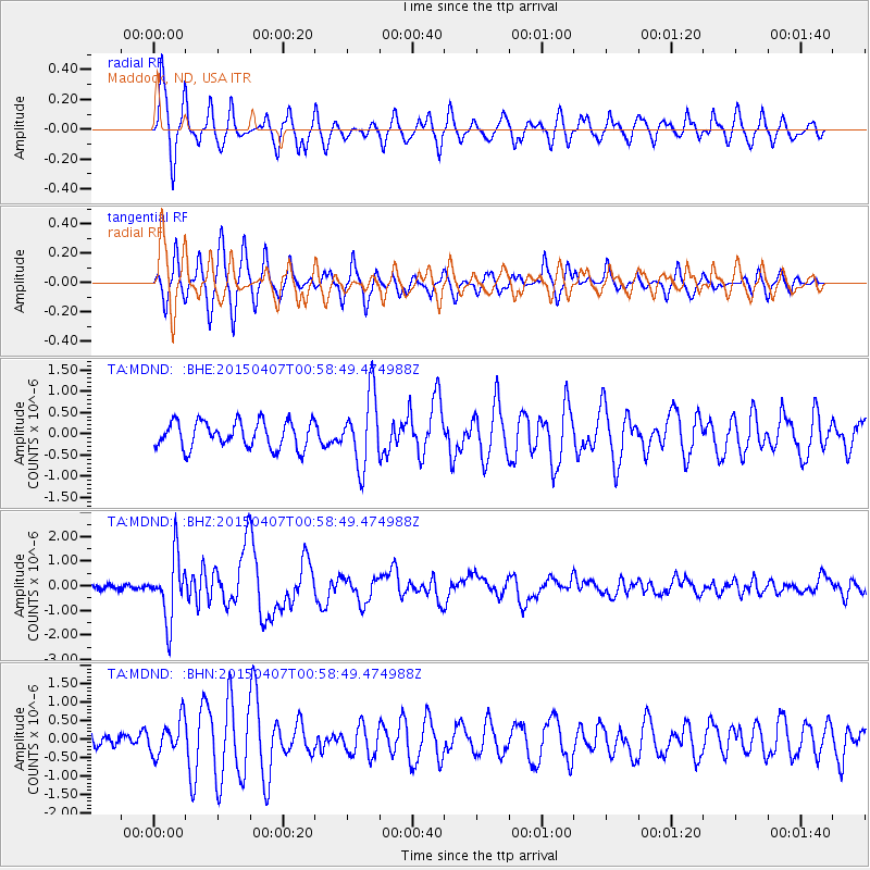
MDND Maddock, ND, USA - Earthquake Result Viewer
*The percent match for this event was below the threshold and hence no stack was calculated.
| Earthquake location: |
Tonga Islands |
| Earthquake latitude/longitude: |
-15.2/-173.2 |
| Earthquake time(UTC): |
2015/04/07 (097) 00:46:18 GMT |
| Earthquake Depth: |
10 km |
| Earthquake Magnitude: |
5.8 MB |
| Earthquake Catalog/Contributor: |
NEIC PDE/NEIC ALERT |
|
| Network: |
TA USArray Transportable Network (new EarthScope stations) |
| Station: |
MDND Maddock, ND, USA |
| Lat/Lon: |
47.85 N/99.60 W |
| Elevation: |
479 m |
|
| Distance: |
90.5 deg |
| Az: |
40.26 deg |
| Baz: |
247.868 deg |
| Ray Param: |
$rayparam |
*The percent match for this event was below the threshold and hence was not used in the summary stack. |
|
| Radial Match: |
80.78797 % |
| Radial Bump: |
396 |
| Transverse Match: |
70.87804 % |
| Transverse Bump: |
313 |
| SOD ConfigId: |
7422571 |
| Insert Time: |
2019-04-18 03:03:01.211 +0000 |
| GWidth: |
2.5 |
| Max Bumps: |
400 |
| Tol: |
0.001 |
|
Signal To Noise
| Channel | StoN | STA | LTA |
| TA:MDND: :BHZ:20150407T00:58:49.474988Z | 8.728422 | 1.27234E-6 | 1.4576976E-7 |
| TA:MDND: :BHN:20150407T00:58:49.474988Z | 1.6506819 | 4.7408884E-7 | 2.8720788E-7 |
| TA:MDND: :BHE:20150407T00:58:49.474988Z | 2.6388857 | 8.1573694E-7 | 3.0912173E-7 |
| Arrivals |
| Ps | |
| PpPs | |
| PsPs/PpSs | |


