You are here: Home > Network List > TA - USArray Transportable Network (new EarthScope stations) Stations List
> Station P51A Williamsport, OH, USA > Earthquake Result Viewer
P51A Williamsport, OH, USA - Earthquake Result Viewer

| Earthquake location: |
Northern Mid-Atlantic Ridge |
| Earthquake latitude/longitude: |
23.8/-45.6 |
| Earthquake time(UTC): |
2014/07/27 (208) 01:28:38 GMT |
| Earthquake Depth: |
10 km |
| Earthquake Magnitude: |
5.6 MB, 6.0 MWB, 6.6 MI |
| Earthquake Catalog/Contributor: |
NEIC PDE/NEIC COMCAT |
|
| Network: |
TA USArray Transportable Network (new EarthScope stations) |
| Station: |
P51A Williamsport, OH, USA |
| Lat/Lon: |
39.48 N/83.06 W |
| Elevation: |
211 m |
|
| Distance: |
35.2 deg |
| Az: |
305.383 deg |
| Baz: |
105.156 deg |
| Ray Param: |
0.077336796 |
| Estimated Moho Depth: |
41.25 km |
| Estimated Crust Vp/Vs: |
2.10 |
| Assumed Crust Vp: |
6.232 km/s |
| Estimated Crust Vs: |
2.971 km/s |
| Estimated Crust Poisson's Ratio: |
0.35 |
|
| Radial Match: |
91.45075 % |
| Radial Bump: |
254 |
| Transverse Match: |
67.14981 % |
| Transverse Bump: |
400 |
| SOD ConfigId: |
769524 |
| Insert Time: |
2014-08-10 02:40:14.104 +0000 |
| GWidth: |
2.5 |
| Max Bumps: |
400 |
| Tol: |
0.001 |
|
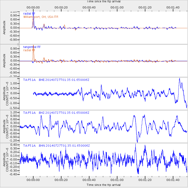
Signal To Noise
| Channel | StoN | STA | LTA |
| TA:P51A: :BHZ:20140727T01:35:01.650006Z | 5.9105453 | 3.4175545E-7 | 5.782131E-8 |
| TA:P51A: :BHN:20140727T01:35:01.650006Z | 1.0057336 | 8.4682036E-8 | 8.4199264E-8 |
| TA:P51A: :BHE:20140727T01:35:01.650006Z | 3.2580516 | 2.552163E-7 | 7.8334025E-8 |
| Arrivals |
| Ps | 7.7 SECOND |
| PpPs | 19 SECOND |
| PsPs/PpSs | 27 SECOND |


