You are here: Home > Network List > TA - USArray Transportable Network (new EarthScope stations) Stations List
> Station W39A Magazine, AR, USA > Earthquake Result Viewer
W39A Magazine, AR, USA - Earthquake Result Viewer

| Earthquake location: |
Northern Mid-Atlantic Ridge |
| Earthquake latitude/longitude: |
23.8/-45.6 |
| Earthquake time(UTC): |
2014/07/27 (208) 01:28:38 GMT |
| Earthquake Depth: |
10 km |
| Earthquake Magnitude: |
5.6 MB, 6.0 MWB, 6.6 MI |
| Earthquake Catalog/Contributor: |
NEIC PDE/NEIC COMCAT |
|
| Network: |
TA USArray Transportable Network (new EarthScope stations) |
| Station: |
W39A Magazine, AR, USA |
| Lat/Lon: |
35.20 N/93.78 W |
| Elevation: |
162 m |
|
| Distance: |
43.1 deg |
| Az: |
296.697 deg |
| Baz: |
91.905 deg |
| Ray Param: |
0.07279595 |
| Estimated Moho Depth: |
19.0 km |
| Estimated Crust Vp/Vs: |
1.79 |
| Assumed Crust Vp: |
6.498 km/s |
| Estimated Crust Vs: |
3.63 km/s |
| Estimated Crust Poisson's Ratio: |
0.27 |
|
| Radial Match: |
85.53955 % |
| Radial Bump: |
400 |
| Transverse Match: |
67.3219 % |
| Transverse Bump: |
400 |
| SOD ConfigId: |
769524 |
| Insert Time: |
2014-08-10 02:44:36.531 +0000 |
| GWidth: |
2.5 |
| Max Bumps: |
400 |
| Tol: |
0.001 |
|
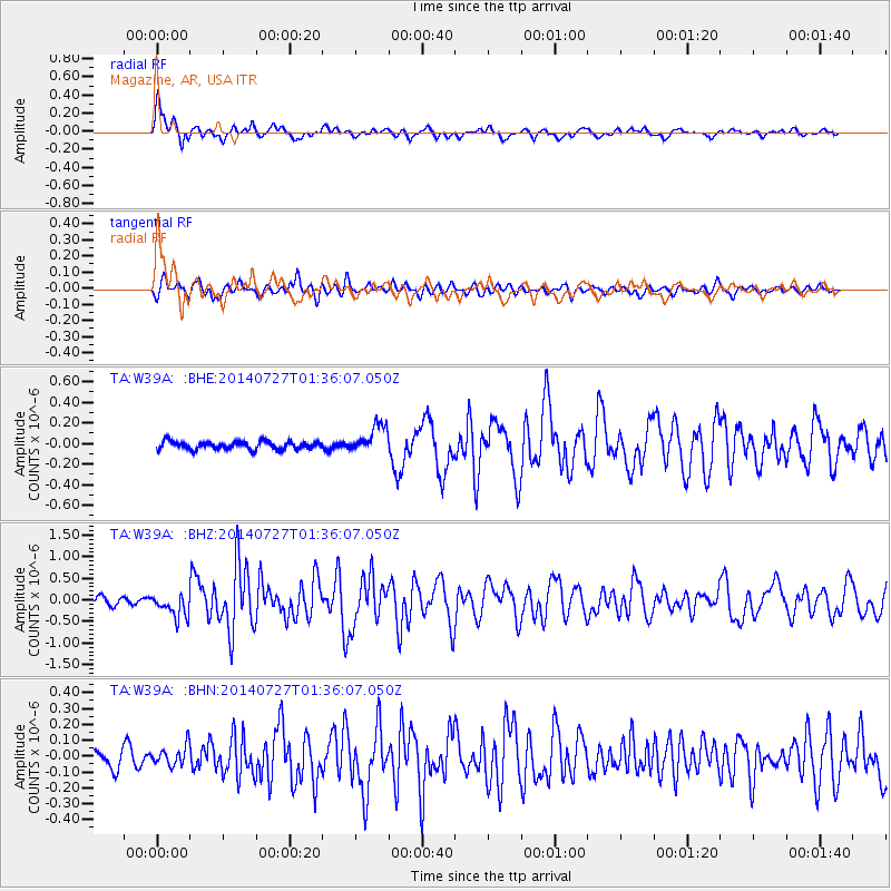
Signal To Noise
| Channel | StoN | STA | LTA |
| TA:W39A: :BHZ:20140727T01:36:07.050Z | 3.2490382 | 2.7477637E-7 | 8.45716E-8 |
| TA:W39A: :BHN:20140727T01:36:07.050Z | 1.4905863 | 6.183683E-8 | 4.1484903E-8 |
| TA:W39A: :BHE:20140727T01:36:07.050Z | 3.5349467 | 1.360017E-7 | 3.847348E-8 |
| Arrivals |
| Ps | 2.5 SECOND |
| PpPs | 7.6 SECOND |
| PsPs/PpSs | 10 SECOND |


