You are here: Home > Network List > TA - USArray Transportable Network (new EarthScope stations) Stations List
> Station G65A Princeton, ME, USA > Earthquake Result Viewer
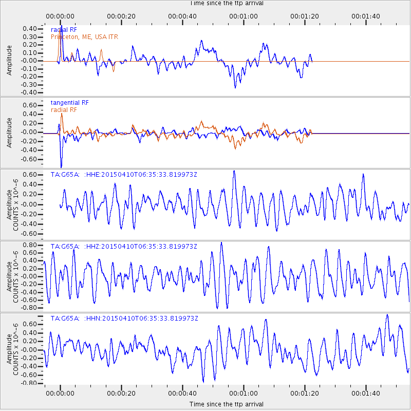
G65A Princeton, ME, USA - Earthquake Result Viewer
*The percent match for this event was below the threshold and hence no stack was calculated.
| Earthquake location: |
Southern Iran |
| Earthquake latitude/longitude: |
28.3/51.8 |
| Earthquake time(UTC): |
2015/04/10 (100) 06:23:14 GMT |
| Earthquake Depth: |
15 km |
| Earthquake Magnitude: |
4.7 MW, 4.1 MS, 4.6 mb |
| Earthquake Catalog/Contributor: |
ISC/ISC |
|
| Network: |
TA USArray Transportable Network (new EarthScope stations) |
| Station: |
G65A Princeton, ME, USA |
| Lat/Lon: |
45.20 N/67.56 W |
| Elevation: |
78 m |
|
| Distance: |
88.4 deg |
| Az: |
321.956 deg |
| Baz: |
50.206 deg |
| Ray Param: |
$rayparam |
*The percent match for this event was below the threshold and hence was not used in the summary stack. |
|
| Radial Match: |
36.025356 % |
| Radial Bump: |
400 |
| Transverse Match: |
64.298996 % |
| Transverse Bump: |
400 |
| SOD ConfigId: |
7422571 |
| Insert Time: |
2019-04-18 03:13:39.905 +0000 |
| GWidth: |
2.5 |
| Max Bumps: |
400 |
| Tol: |
0.001 |
|
Signal To Noise
| Channel | StoN | STA | LTA |
| TA:G65A: :HHZ:20150410T06:35:33.819973Z | 1.2963117 | 3.4865246E-7 | 2.6895725E-7 |
| TA:G65A: :HHN:20150410T06:35:33.819973Z | 0.82268035 | 2.4821708E-7 | 3.0171753E-7 |
| TA:G65A: :HHE:20150410T06:35:33.819973Z | 0.6837273 | 1.4165504E-7 | 2.071806E-7 |
| Arrivals |
| Ps | |
| PpPs | |
| PsPs/PpSs | |


