You are here: Home > Network List > AV - Alaska Volcano Observatory Stations List
> Station MAPS Pakushin Southeast, Makushin Volcano, Alaska > Earthquake Result Viewer
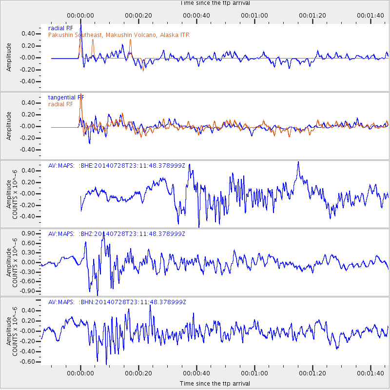
MAPS Pakushin Southeast, Makushin Volcano, Alaska - Earthquake Result Viewer
*The percent match for this event was below the threshold and hence no stack was calculated.
| Earthquake location: |
New Guinea, Papua New Guinea |
| Earthquake latitude/longitude: |
-6.9/143.8 |
| Earthquake time(UTC): |
2014/07/28 (209) 23:00:48 GMT |
| Earthquake Depth: |
10 km |
| Earthquake Magnitude: |
5.8 MB |
| Earthquake Catalog/Contributor: |
NEIC PDE/NEIC COMCAT |
|
| Network: |
AV Alaska Volcano Observatory |
| Station: |
MAPS Pakushin Southeast, Makushin Volcano, Alaska |
| Lat/Lon: |
53.81 N/166.94 W |
| Elevation: |
333 m |
|
| Distance: |
73.2 deg |
| Az: |
27.968 deg |
| Baz: |
231.731 deg |
| Ray Param: |
$rayparam |
*The percent match for this event was below the threshold and hence was not used in the summary stack. |
|
| Radial Match: |
60.34844 % |
| Radial Bump: |
400 |
| Transverse Match: |
54.934944 % |
| Transverse Bump: |
400 |
| SOD ConfigId: |
769524 |
| Insert Time: |
2014-08-11 23:26:55.413 +0000 |
| GWidth: |
2.5 |
| Max Bumps: |
400 |
| Tol: |
0.001 |
|
Signal To Noise
| Channel | StoN | STA | LTA |
| AV:MAPS: :BHZ:20140728T23:11:48.378999Z | 5.160791 | 3.989924E-7 | 7.731226E-8 |
| AV:MAPS: :BHN:20140728T23:11:48.378999Z | 2.1311803 | 1.7529791E-7 | 8.225391E-8 |
| AV:MAPS: :BHE:20140728T23:11:48.378999Z | 2.5777118 | 2.1702523E-7 | 8.419298E-8 |
| Arrivals |
| Ps | |
| PpPs | |
| PsPs/PpSs | |


