
TAU Hobart, Tasmania, Australia - Earthquake Result Viewer
| ||||||||||||||||||
| ||||||||||||||||||
| ||||||||||||||||||
|
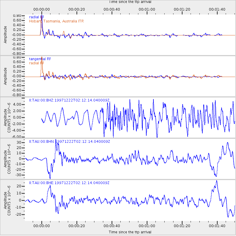
Signal To Noise
| Channel | StoN | STA | LTA |
| II:TAU:00:BHN:19971222T02:12:14.040009Z | 7.7905154 | 1.4203222E-5 | 1.8231427E-6 |
| II:TAU:00:BHE:19971222T02:12:14.040009Z | 6.7288356 | 9.325012E-6 | 1.3858286E-6 |
| II:TAU:00:BHZ:19971222T02:12:14.040009Z | 1.2593621 | 1.7320544E-6 | 1.3753427E-6 |
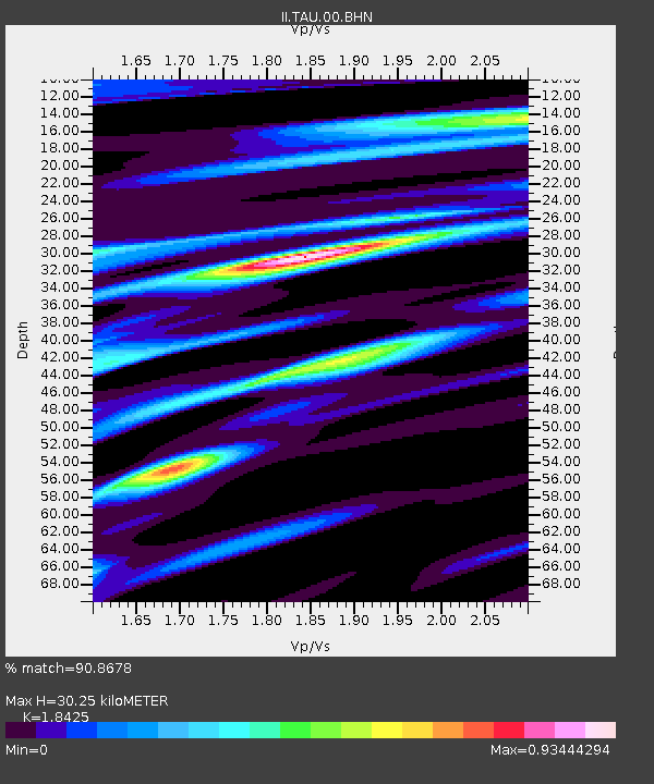
| Arrivals | |
| Ps | 4.2 SECOND |
| PpPs | 12 SECOND |
| PsPs/PpSs | 17 SECOND |

