TAU Hobart, Tasmania, Australia - Earthquake Result Viewer
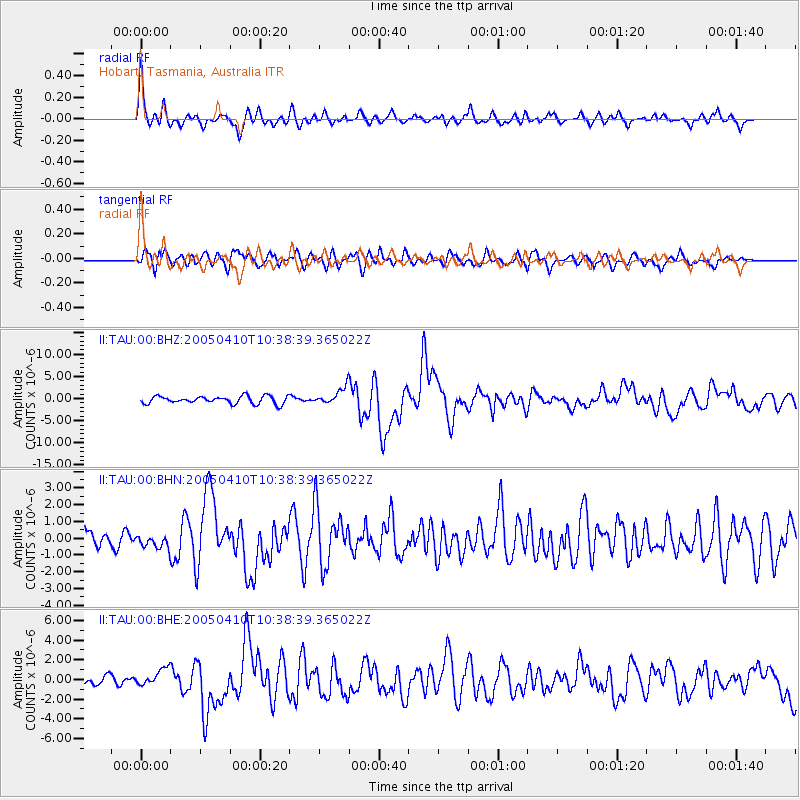
Earthquake location: Southern Sumatra, Indonesia
Earthquake latitude/longitude: -1.6/99.6
Earthquake time(UTC): 2005/04/10 (100) 10:29:11 GMT
Earthquake Depth: 19 km
Earthquake Magnitude: 6.4 MB, 6.7 MS, 6.7 MW, 6.6 MW
Earthquake Catalog/Contributor: WHDF/NEIC
Network: II Global Seismograph Network (GSN - IRIS/IDA)
Station: TAU Hobart, Tasmania, Australia
Lat/Lon: 42.91 S/147.32 E
Elevation: 132 m
Distance: 59.1 deg
Az: 140.699 deg
Baz: 300.485 deg
Ray Param: 0.062387947
Estimated Moho Depth: 33.25 km
Estimated Crust Vp/Vs: 1.68
Assumed Crust Vp: 6.477 km/s
Estimated Crust Vs: 3.867 km/s
Estimated Crust Poisson's Ratio: 0.22
Radial Match: 84.52869 %
Radial Bump: 400
Transverse Match: 77.79379 %
Transverse Bump: 400
SOD ConfigId: 2459
Insert Time: 2010-03-02 00:32:54.839 +0000
GWidth: 2.5
Max Bumps: 400
Tol: 0.001

Signal To Noise

ChannelStoNSTALTA
II:TAU:00:BHN:20050410T10:38:39.365022Z0.50356853.9656268E-77.87505E-7
II:TAU:00:BHE:20050410T10:38:39.365022Z2.62684238.6579087E-73.2959377E-7
II:TAU:00:BHZ:20050410T10:38:39.365022Z2.18648531.8631755E-68.5213264E-7
Arrivals
Ps3.6 SECOND
PpPs13 SECOND
PsPs/PpSs17 SECOND