
TAU Hobart, Tasmania, Australia - Earthquake Result Viewer
| ||||||||||||||||||
| ||||||||||||||||||
| ||||||||||||||||||
|
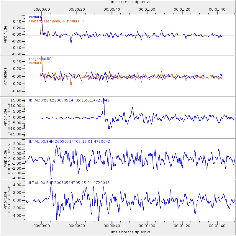
Signal To Noise
| Channel | StoN | STA | LTA |
| II:TAU:00:BHN:20050514T05:15:01.472004Z | 1.5490934 | 5.187797E-7 | 3.348925E-7 |
| II:TAU:00:BHE:20050514T05:15:01.472004Z | 1.826902 | 6.2997213E-7 | 3.4483082E-7 |
| II:TAU:00:BHZ:20050514T05:15:01.472004Z | 3.885982 | 1.757849E-6 | 4.5235646E-7 |
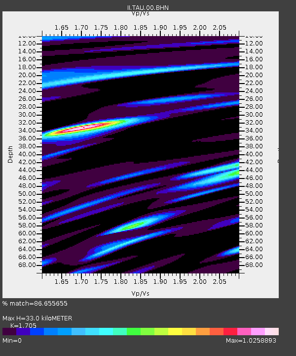
| Arrivals | |
| Ps | 3.8 SECOND |
| PpPs | 13 SECOND |
| PsPs/PpSs | 17 SECOND |

