
TAU Hobart, Tasmania, Australia - Earthquake Result Viewer
| ||||||||||||||||||
| ||||||||||||||||||
| ||||||||||||||||||
|
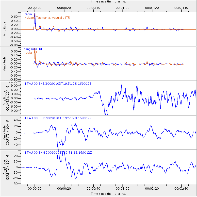
Signal To Noise
| Channel | StoN | STA | LTA |
| II:TAU:00:BHZ:20090103T19:51:28.169012Z | 2.805607 | 1.6133607E-6 | 5.750487E-7 |
| II:TAU:00:BHN:20090103T19:51:28.169012Z | 2.5522673 | 1.1127898E-6 | 4.360005E-7 |
| II:TAU:00:BHE:20090103T19:51:28.169012Z | 1.358927 | 5.3901994E-7 | 3.9665113E-7 |
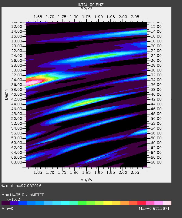
| Arrivals | |
| Ps | 3.6 SECOND |
| PpPs | 13 SECOND |
| PsPs/PpSs | 17 SECOND |

