TAU Hobart, Tasmania, Australia - Earthquake Result Viewer
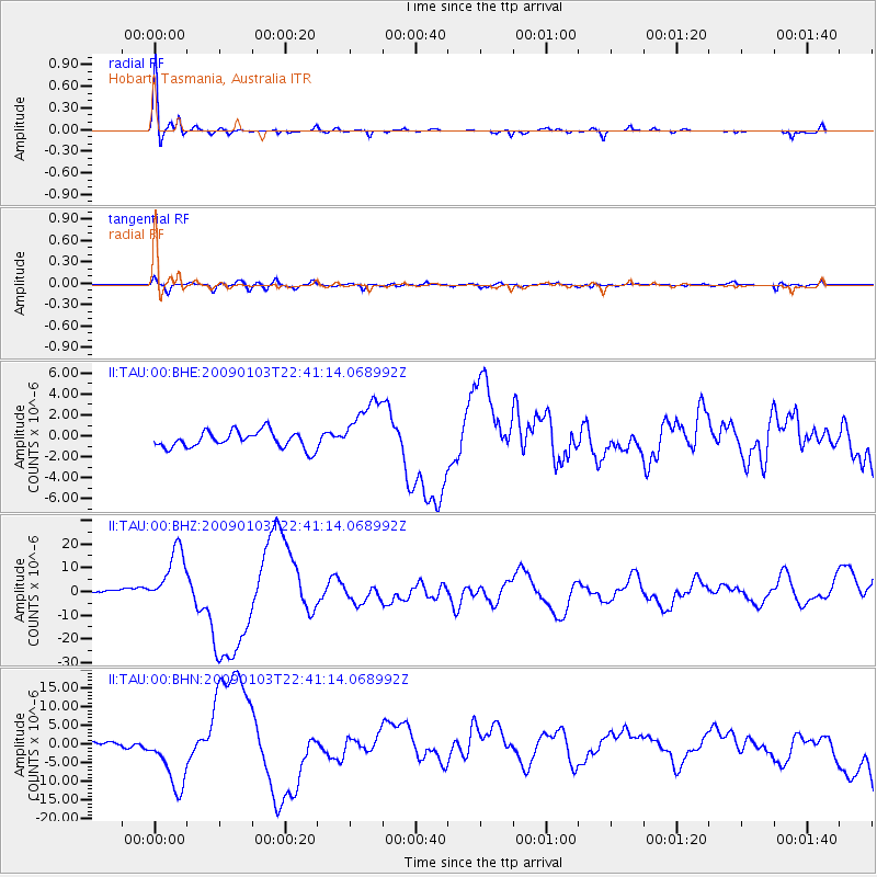
Earthquake location: Irian Jaya Region, Indonesia
Earthquake latitude/longitude: -0.7/133.3
Earthquake time(UTC): 2009/01/03 (003) 22:33:40 GMT
Earthquake Depth: 23 km
Earthquake Magnitude: 6.7 MB, 7.4 MS, 7.4 MW, 7.3 MW
Earthquake Catalog/Contributor: WHDF/NEIC
Network: II Global Seismograph Network (GSN - IRIS/IDA)
Station: TAU Hobart, Tasmania, Australia
Lat/Lon: 42.91 S/147.32 E
Elevation: 132 m
Distance: 43.9 deg
Az: 165.123 deg
Baz: 339.548 deg
Ray Param: 0.0722338
Estimated Moho Depth: 14.25 km
Estimated Crust Vp/Vs: 2.08
Assumed Crust Vp: 6.477 km/s
Estimated Crust Vs: 3.118 km/s
Estimated Crust Poisson's Ratio: 0.35
Radial Match: 95.26724 %
Radial Bump: 310
Transverse Match: 81.40736 %
Transverse Bump: 400
SOD ConfigId: 2834
Insert Time: 2010-03-02 00:33:13.919 +0000
GWidth: 2.5
Max Bumps: 400
Tol: 0.001

Signal To Noise

ChannelStoNSTALTA
II:TAU:00:BHZ:20090103T22:41:14.068992Z13.1376521.2611816E-59.599748E-7
II:TAU:00:BHN:20090103T22:41:14.068992Z13.1592178.343545E-66.340457E-7
II:TAU:00:BHE:20090103T22:41:14.068992Z3.45024852.7384388E-67.936932E-7
Arrivals
Ps2.5 SECOND
PpPs6.4 SECOND
PsPs/PpSs8.9 SECOND