You are here: Home > Network List > TA - USArray Transportable Network (new EarthScope stations) Stations List
> Station 121A Cookes Peak, Deming, NM, USA > Earthquake Result Viewer
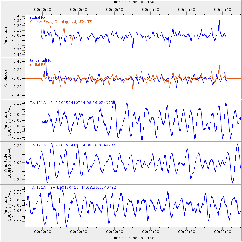
121A Cookes Peak, Deming, NM, USA - Earthquake Result Viewer
*The percent match for this event was below the threshold and hence no stack was calculated.
| Earthquake location: |
Kuril Islands |
| Earthquake latitude/longitude: |
47.1/150.8 |
| Earthquake time(UTC): |
2015/04/10 (100) 13:57:53 GMT |
| Earthquake Depth: |
200 km |
| Earthquake Magnitude: |
4.1 mb, 3.9 mb |
| Earthquake Catalog/Contributor: |
ISC/ISC |
|
| Network: |
TA USArray Transportable Network (new EarthScope stations) |
| Station: |
121A Cookes Peak, Deming, NM, USA |
| Lat/Lon: |
32.53 N/107.79 W |
| Elevation: |
1652 m |
|
| Distance: |
74.0 deg |
| Az: |
59.49 deg |
| Baz: |
315.82 deg |
| Ray Param: |
$rayparam |
*The percent match for this event was below the threshold and hence was not used in the summary stack. |
|
| Radial Match: |
46.323364 % |
| Radial Bump: |
400 |
| Transverse Match: |
49.564663 % |
| Transverse Bump: |
400 |
| SOD ConfigId: |
7422571 |
| Insert Time: |
2019-04-18 03:32:43.955 +0000 |
| GWidth: |
2.5 |
| Max Bumps: |
400 |
| Tol: |
0.001 |
|
Signal To Noise
| Channel | StoN | STA | LTA |
| TA:121A: :BHZ:20150410T14:08:36.024973Z | 1.7879003 | 1.4484235E-7 | 8.1012544E-8 |
| TA:121A: :BHN:20150410T14:08:36.024973Z | 1.5538212 | 1.097628E-7 | 7.064056E-8 |
| TA:121A: :BHE:20150410T14:08:36.024973Z | 1.353932 | 6.595899E-8 | 4.8716622E-8 |
| Arrivals |
| Ps | |
| PpPs | |
| PsPs/PpSs | |


