You are here: Home > Network List > TA - USArray Transportable Network (new EarthScope stations) Stations List
> Station I59A Olmsteadville, NY, USA > Earthquake Result Viewer
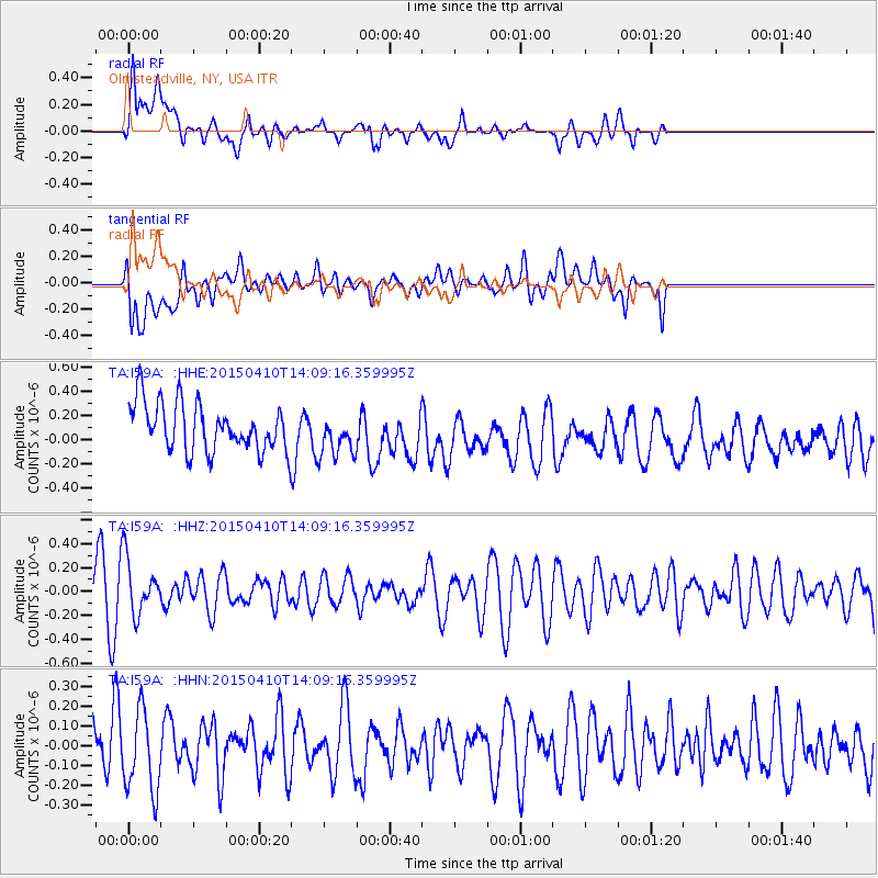
I59A Olmsteadville, NY, USA - Earthquake Result Viewer
*The percent match for this event was below the threshold and hence no stack was calculated.
| Earthquake location: |
Kuril Islands |
| Earthquake latitude/longitude: |
47.1/150.8 |
| Earthquake time(UTC): |
2015/04/10 (100) 13:57:53 GMT |
| Earthquake Depth: |
200 km |
| Earthquake Magnitude: |
4.1 mb, 3.9 mb |
| Earthquake Catalog/Contributor: |
ISC/ISC |
|
| Network: |
TA USArray Transportable Network (new EarthScope stations) |
| Station: |
I59A Olmsteadville, NY, USA |
| Lat/Lon: |
43.80 N/73.87 W |
| Elevation: |
390 m |
|
| Distance: |
81.3 deg |
| Az: |
30.995 deg |
| Baz: |
330.926 deg |
| Ray Param: |
$rayparam |
*The percent match for this event was below the threshold and hence was not used in the summary stack. |
|
| Radial Match: |
65.63645 % |
| Radial Bump: |
400 |
| Transverse Match: |
52.96963 % |
| Transverse Bump: |
400 |
| SOD ConfigId: |
7422571 |
| Insert Time: |
2019-04-18 03:32:56.997 +0000 |
| GWidth: |
2.5 |
| Max Bumps: |
400 |
| Tol: |
0.001 |
|
Signal To Noise
| Channel | StoN | STA | LTA |
| TA:I59A: :HHZ:20150410T14:09:16.359995Z | 1.4390972 | 2.3900316E-7 | 1.6607855E-7 |
| TA:I59A: :HHN:20150410T14:09:16.359995Z | 1.3051829 | 2.0186926E-7 | 1.546674E-7 |
| TA:I59A: :HHE:20150410T14:09:16.359995Z | 0.9089782 | 1.7763273E-7 | 1.9542021E-7 |
| Arrivals |
| Ps | |
| PpPs | |
| PsPs/PpSs | |


