You are here: Home > Network List > TA - USArray Transportable Network (new EarthScope stations) Stations List
> Station D48A Paudash Township, ON, CAN > Earthquake Result Viewer
D48A Paudash Township, ON, CAN - Earthquake Result Viewer

| Earthquake location: |
Oaxaca, Mexico |
| Earthquake latitude/longitude: |
17.8/-95.5 |
| Earthquake time(UTC): |
2014/07/29 (210) 10:46:15 GMT |
| Earthquake Depth: |
95 km |
| Earthquake Magnitude: |
6.3 MWP |
| Earthquake Catalog/Contributor: |
NEIC PDE/NEIC COMCAT |
|
| Network: |
TA USArray Transportable Network (new EarthScope stations) |
| Station: |
D48A Paudash Township, ON, CAN |
| Lat/Lon: |
47.17 N/81.81 W |
| Elevation: |
434 m |
|
| Distance: |
31.4 deg |
| Az: |
18.113 deg |
| Baz: |
205.725 deg |
| Ray Param: |
0.078863166 |
| Estimated Moho Depth: |
11.0 km |
| Estimated Crust Vp/Vs: |
2.10 |
| Assumed Crust Vp: |
6.467 km/s |
| Estimated Crust Vs: |
3.083 km/s |
| Estimated Crust Poisson's Ratio: |
0.35 |
|
| Radial Match: |
93.391624 % |
| Radial Bump: |
400 |
| Transverse Match: |
76.79603 % |
| Transverse Bump: |
400 |
| SOD ConfigId: |
769524 |
| Insert Time: |
2014-08-12 11:16:25.815 +0000 |
| GWidth: |
2.5 |
| Max Bumps: |
400 |
| Tol: |
0.001 |
|
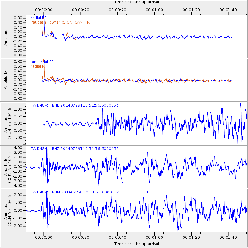
Signal To Noise
| Channel | StoN | STA | LTA |
| TA:D48A: :BHZ:20140729T10:51:56.600015Z | 20.131983 | 1.8900066E-6 | 9.38808E-8 |
| TA:D48A: :BHN:20140729T10:51:56.600015Z | 12.986028 | 1.1512603E-6 | 8.865377E-8 |
| TA:D48A: :BHE:20140729T10:51:56.600015Z | 4.901384 | 4.3243776E-7 | 8.822769E-8 |
| Arrivals |
| Ps | 2.0 SECOND |
| PpPs | 4.9 SECOND |
| PsPs/PpSs | 6.9 SECOND |


