
TAU Hobart, Tasmania, Australia - Earthquake Result Viewer
| ||||||||||||||||||
| ||||||||||||||||||
| ||||||||||||||||||
|
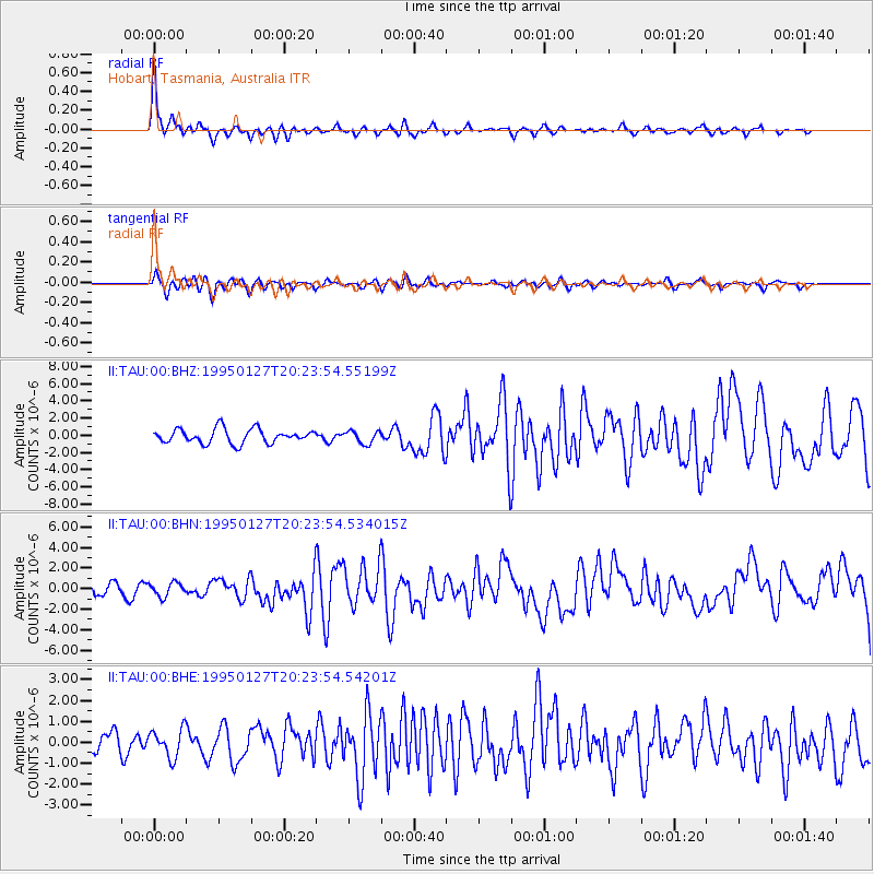
Signal To Noise
| Channel | StoN | STA | LTA |
| II:TAU:00:BHN:19950127T20:23:54.534015Z | 1.7330866 | 6.638131E-7 | 3.8302363E-7 |
| II:TAU:00:BHE:19950127T20:23:54.54201Z | 1.3488227 | 6.7394404E-7 | 4.9965354E-7 |
| II:TAU:00:BHZ:19950127T20:23:54.55199Z | 0.9000342 | 7.437185E-7 | 8.263225E-7 |
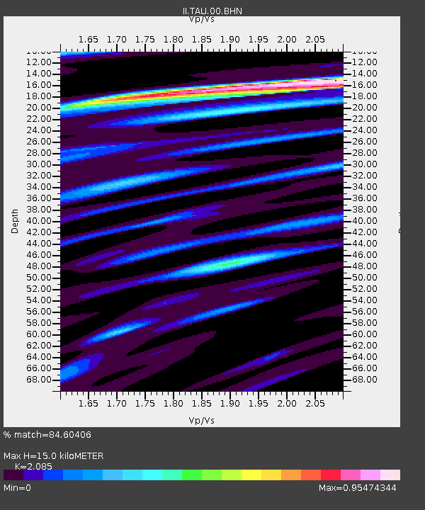
| Arrivals | |
| Ps | 2.7 SECOND |
| PpPs | 6.7 SECOND |
| PsPs/PpSs | 9.4 SECOND |

