TAU Hobart, Tasmania, Australia - Earthquake Result Viewer
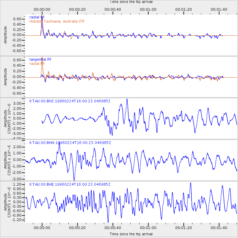
Earthquake location: Irian Jaya Region, Indonesia
Earthquake latitude/longitude: -0.9/137.3
Earthquake time(UTC): 1996/02/24 (055) 15:52:59 GMT
Earthquake Depth: 33 km
Earthquake Magnitude: 5.6 MB, 5.9 MS, 6.2 UNKNOWN, 6.2 MW
Earthquake Catalog/Contributor: WHDF/NEIC
Network: II Global Seismograph Network (GSN - IRIS/IDA)
Station: TAU Hobart, Tasmania, Australia
Lat/Lon: 42.91 S/147.32 E
Elevation: 132 m
Distance: 42.8 deg
Az: 169.2 deg
Baz: 345.226 deg
Ray Param: 0.07291214
Estimated Moho Depth: 33.75 km
Estimated Crust Vp/Vs: 1.65
Assumed Crust Vp: 6.477 km/s
Estimated Crust Vs: 3.925 km/s
Estimated Crust Poisson's Ratio: 0.21
Radial Match: 81.2677 %
Radial Bump: 393
Transverse Match: 61.60825 %
Transverse Bump: 400
SOD ConfigId: 6273
Insert Time: 2010-03-02 00:34:07.998 +0000
GWidth: 2.5
Max Bumps: 400
Tol: 0.001

Signal To Noise

ChannelStoNSTALTA
II:TAU:00:BHN:19960224T16:00:23.046985Z1.50641053.3131144E-72.1993438E-7
II:TAU:00:BHE:19960224T16:00:23.046985Z0.59733422.0683109E-73.462569E-7
II:TAU:00:BHZ:19960224T16:00:23.046985Z1.88261198.3352967E-74.427517E-7
Arrivals
Ps3.6 SECOND
PpPs13 SECOND
PsPs/PpSs16 SECOND