TAU Hobart, Tasmania, Australia - Earthquake Result Viewer
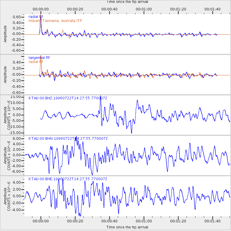
Earthquake location: Minahassa Peninsula, Sulawesi
Earthquake latitude/longitude: 1.0/120.4
Earthquake time(UTC): 1996/07/22 (204) 14:19:35 GMT
Earthquake Depth: 33 km
Earthquake Magnitude: 6.0 MB, 6.9 MS, 7.0 UNKNOWN, 6.9 MW
Earthquake Catalog/Contributor: WHDF/NEIC
Network: II Global Seismograph Network (GSN - IRIS/IDA)
Station: TAU Hobart, Tasmania, Australia
Lat/Lon: 42.91 S/147.32 E
Elevation: 132 m
Distance: 49.9 deg
Az: 154.289 deg
Baz: 323.815 deg
Ray Param: 0.06831585
Estimated Moho Depth: 36.0 km
Estimated Crust Vp/Vs: 1.64
Assumed Crust Vp: 6.477 km/s
Estimated Crust Vs: 3.949 km/s
Estimated Crust Poisson's Ratio: 0.20
Radial Match: 86.87113 %
Radial Bump: 394
Transverse Match: 54.55262 %
Transverse Bump: 400
SOD ConfigId: 6273
Insert Time: 2010-03-02 00:34:15.015 +0000
GWidth: 2.5
Max Bumps: 400
Tol: 0.001

Signal To Noise

ChannelStoNSTALTA
II:TAU:00:BHN:19960722T14:27:55.770007Z2.60972171.7252833E-66.610986E-7
II:TAU:00:BHE:19960722T14:27:55.770007Z1.67347571.3023395E-67.7822426E-7
II:TAU:00:BHZ:19960722T14:27:55.770007Z2.36824774.09957E-61.7310563E-6
Arrivals
Ps3.8 SECOND
PpPs14 SECOND
PsPs/PpSs18 SECOND