You are here: Home > Network List > TA - USArray Transportable Network (new EarthScope stations) Stations List
> Station O03E Paynes Creek, CA, USA > Earthquake Result Viewer
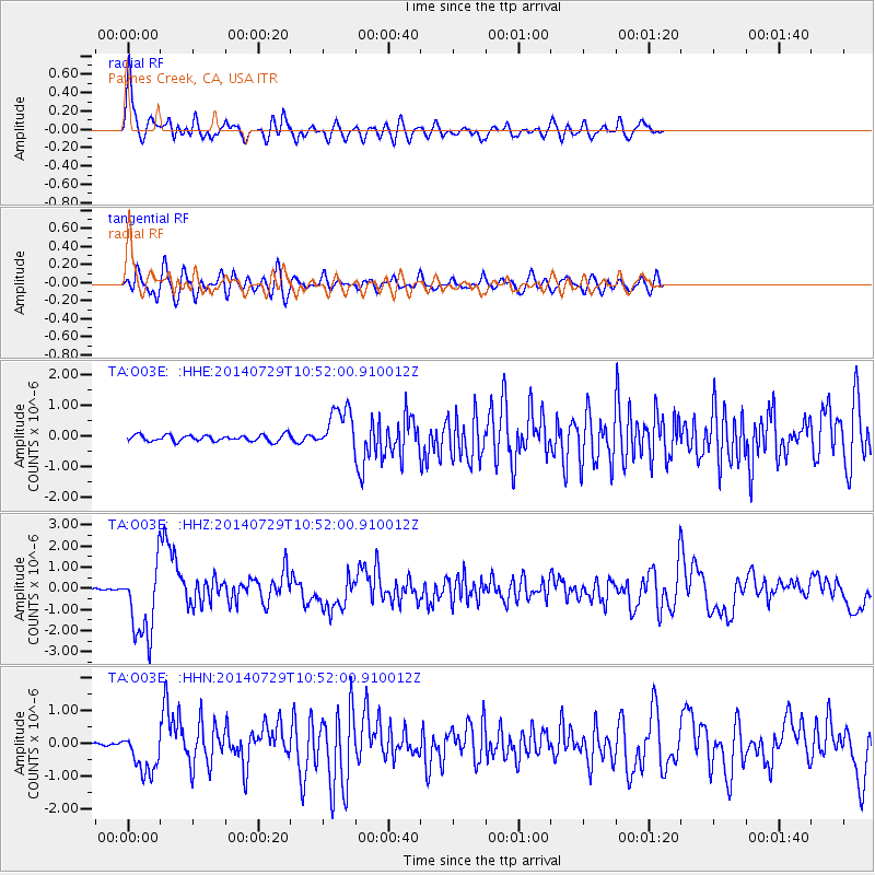
O03E Paynes Creek, CA, USA - Earthquake Result Viewer
*The percent match for this event was below the threshold and hence no stack was calculated.
| Earthquake location: |
Oaxaca, Mexico |
| Earthquake latitude/longitude: |
17.8/-95.5 |
| Earthquake time(UTC): |
2014/07/29 (210) 10:46:15 GMT |
| Earthquake Depth: |
95 km |
| Earthquake Magnitude: |
6.3 MWP |
| Earthquake Catalog/Contributor: |
NEIC PDE/NEIC COMCAT |
|
| Network: |
TA USArray Transportable Network (new EarthScope stations) |
| Station: |
O03E Paynes Creek, CA, USA |
| Lat/Lon: |
40.29 N/121.80 W |
| Elevation: |
967 m |
|
| Distance: |
31.9 deg |
| Az: |
320.082 deg |
| Baz: |
126.955 deg |
| Ray Param: |
$rayparam |
*The percent match for this event was below the threshold and hence was not used in the summary stack. |
|
| Radial Match: |
77.50948 % |
| Radial Bump: |
400 |
| Transverse Match: |
60.097275 % |
| Transverse Bump: |
400 |
| SOD ConfigId: |
769524 |
| Insert Time: |
2014-08-12 11:24:50.303 +0000 |
| GWidth: |
2.5 |
| Max Bumps: |
400 |
| Tol: |
0.001 |
|
Signal To Noise
| Channel | StoN | STA | LTA |
| TA:O03E: :HHZ:20140729T10:52:00.910012Z | 18.619432 | 1.7497118E-6 | 9.397235E-8 |
| TA:O03E: :HHN:20140729T10:52:00.910012Z | 12.35811 | 6.525202E-7 | 5.280097E-8 |
| TA:O03E: :HHE:20140729T10:52:00.910012Z | 6.8665247 | 7.0243857E-7 | 1.02299E-7 |
| Arrivals |
| Ps | |
| PpPs | |
| PsPs/PpSs | |


