You are here: Home > Network List > US - United States National Seismic Network Stations List
> Station DGMT Dagmar, Montana, USA > Earthquake Result Viewer
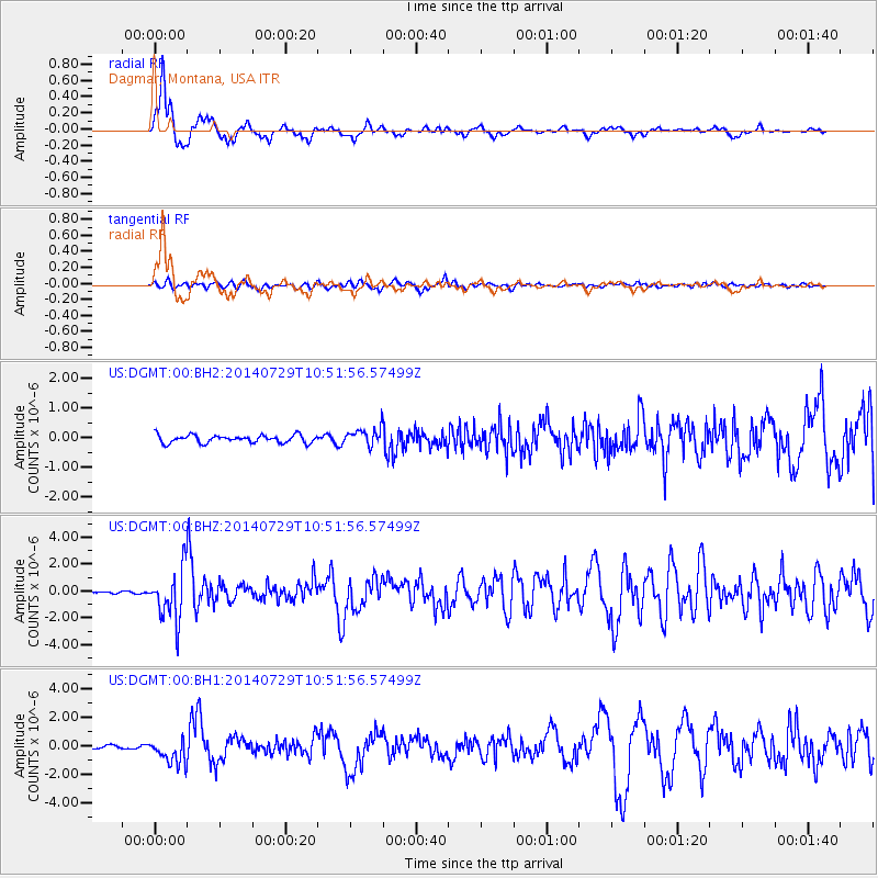
DGMT Dagmar, Montana, USA - Earthquake Result Viewer
*The percent match for this event was below the threshold and hence no stack was calculated.
| Earthquake location: |
Oaxaca, Mexico |
| Earthquake latitude/longitude: |
17.8/-95.5 |
| Earthquake time(UTC): |
2014/07/29 (210) 10:46:15 GMT |
| Earthquake Depth: |
95 km |
| Earthquake Magnitude: |
6.3 MWP |
| Earthquake Catalog/Contributor: |
NEIC PDE/NEIC COMCAT |
|
| Network: |
US United States National Seismic Network |
| Station: |
DGMT Dagmar, Montana, USA |
| Lat/Lon: |
48.47 N/104.20 W |
| Elevation: |
0.0 m |
|
| Distance: |
31.4 deg |
| Az: |
348.883 deg |
| Baz: |
163.981 deg |
| Ray Param: |
$rayparam |
*The percent match for this event was below the threshold and hence was not used in the summary stack. |
|
| Radial Match: |
91.364204 % |
| Radial Bump: |
348 |
| Transverse Match: |
66.5235 % |
| Transverse Bump: |
400 |
| SOD ConfigId: |
769524 |
| Insert Time: |
2014-08-12 11:26:06.835 +0000 |
| GWidth: |
2.5 |
| Max Bumps: |
400 |
| Tol: |
0.001 |
|
Signal To Noise
| Channel | StoN | STA | LTA |
| US:DGMT:00:BHZ:20140729T10:51:56.57499Z | 22.29831 | 1.9047684E-6 | 8.54221E-8 |
| US:DGMT:00:BH1:20140729T10:51:56.57499Z | 5.8226867 | 8.8130935E-7 | 1.5135785E-7 |
| US:DGMT:00:BH2:20140729T10:51:56.57499Z | 2.2470934 | 2.9457726E-7 | 1.3109258E-7 |
| Arrivals |
| Ps | |
| PpPs | |
| PsPs/PpSs | |


