You are here: Home > Network List > CI - Caltech Regional Seismic Network Stations List
> Station DGR Domenigoni Reservoir, California, USA > Earthquake Result Viewer
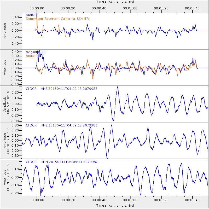
DGR Domenigoni Reservoir, California, USA - Earthquake Result Viewer
*The percent match for this event was below the threshold and hence no stack was calculated.
| Earthquake location: |
Northwest Of Kuril Islands |
| Earthquake latitude/longitude: |
52.0/153.2 |
| Earthquake time(UTC): |
2015/04/11 (101) 03:59:53 GMT |
| Earthquake Depth: |
433 km |
| Earthquake Magnitude: |
4.7 mb, 4.7 mb |
| Earthquake Catalog/Contributor: |
ISC/ISC |
|
| Network: |
CI Caltech Regional Seismic Network |
| Station: |
DGR Domenigoni Reservoir, California, USA |
| Lat/Lon: |
33.65 N/117.01 W |
| Elevation: |
609 m |
|
| Distance: |
64.2 deg |
| Az: |
67.926 deg |
| Baz: |
316.672 deg |
| Ray Param: |
$rayparam |
*The percent match for this event was below the threshold and hence was not used in the summary stack. |
|
| Radial Match: |
75.748665 % |
| Radial Bump: |
400 |
| Transverse Match: |
53.620808 % |
| Transverse Bump: |
400 |
| SOD ConfigId: |
7422571 |
| Insert Time: |
2019-04-18 03:39:50.244 +0000 |
| GWidth: |
2.5 |
| Max Bumps: |
400 |
| Tol: |
0.001 |
|
Signal To Noise
| Channel | StoN | STA | LTA |
| CI:DGR: :HHZ:20150411T04:09:13.207998Z | 0.5557887 | 5.0764495E-8 | 9.133776E-8 |
| CI:DGR: :HHN:20150411T04:09:13.207998Z | 1.9836174 | 1.3491974E-7 | 6.8017016E-8 |
| CI:DGR: :HHE:20150411T04:09:13.207998Z | 1.0797634 | 3.9283634E-8 | 3.6381707E-8 |
| Arrivals |
| Ps | |
| PpPs | |
| PsPs/PpSs | |


