You are here: Home > Network List > GS - US Geological Survey Networks Stations List
> Station DEC06 Boomer > Earthquake Result Viewer
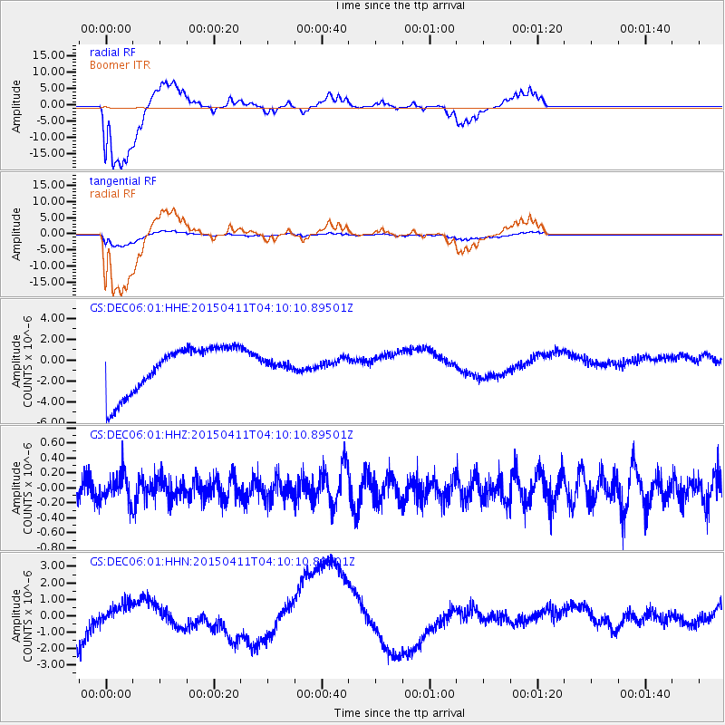
DEC06 Boomer - Earthquake Result Viewer
*The percent match for this event was below the threshold and hence no stack was calculated.
| Earthquake location: |
Northwest Of Kuril Islands |
| Earthquake latitude/longitude: |
52.0/153.2 |
| Earthquake time(UTC): |
2015/04/11 (101) 03:59:53 GMT |
| Earthquake Depth: |
433 km |
| Earthquake Magnitude: |
4.7 mb, 4.7 mb |
| Earthquake Catalog/Contributor: |
ISC/ISC |
|
| Network: |
GS US Geological Survey Networks |
| Station: |
DEC06 Boomer |
| Lat/Lon: |
39.90 N/88.95 W |
| Elevation: |
215 m |
|
| Distance: |
73.7 deg |
| Az: |
45.122 deg |
| Baz: |
325.326 deg |
| Ray Param: |
$rayparam |
*The percent match for this event was below the threshold and hence was not used in the summary stack. |
|
| Radial Match: |
65.55939 % |
| Radial Bump: |
400 |
| Transverse Match: |
63.856518 % |
| Transverse Bump: |
400 |
| SOD ConfigId: |
7422571 |
| Insert Time: |
2019-04-18 03:41:03.807 +0000 |
| GWidth: |
2.5 |
| Max Bumps: |
400 |
| Tol: |
0.001 |
|
Signal To Noise
| Channel | StoN | STA | LTA |
| GS:DEC06:01:HHZ:20150411T04:10:10.89501Z | 1.0812004 | 1.749338E-7 | 1.6179591E-7 |
| GS:DEC06:01:HHN:20150411T04:10:10.89501Z | 0.24877201 | 1.2616408E-6 | 5.0714743E-6 |
| GS:DEC06:01:HHE:20150411T04:10:10.89501Z | 0.1890962 | 4.2876852E-7 | 2.2674624E-6 |
| Arrivals |
| Ps | |
| PpPs | |
| PsPs/PpSs | |


