You are here: Home > Network List > TA - USArray Transportable Network (new EarthScope stations) Stations List
> Station G59A Clarenceville, QC, USA > Earthquake Result Viewer
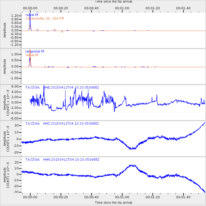
G59A Clarenceville, QC, USA - Earthquake Result Viewer
*The percent match for this event was below the threshold and hence no stack was calculated.
| Earthquake location: |
Northwest Of Kuril Islands |
| Earthquake latitude/longitude: |
52.0/153.2 |
| Earthquake time(UTC): |
2015/04/11 (101) 03:59:53 GMT |
| Earthquake Depth: |
433 km |
| Earthquake Magnitude: |
4.7 mb, 4.7 mb |
| Earthquake Catalog/Contributor: |
ISC/ISC |
|
| Network: |
TA USArray Transportable Network (new EarthScope stations) |
| Station: |
G59A Clarenceville, QC, USA |
| Lat/Lon: |
45.08 N/73.18 W |
| Elevation: |
36 m |
|
| Distance: |
75.3 deg |
| Az: |
32.016 deg |
| Baz: |
332.472 deg |
| Ray Param: |
$rayparam |
*The percent match for this event was below the threshold and hence was not used in the summary stack. |
|
| Radial Match: |
99.82567 % |
| Radial Bump: |
23 |
| Transverse Match: |
98.873436 % |
| Transverse Bump: |
88 |
| SOD ConfigId: |
7422571 |
| Insert Time: |
2019-04-18 03:44:21.284 +0000 |
| GWidth: |
2.5 |
| Max Bumps: |
400 |
| Tol: |
0.001 |
|
Signal To Noise
| Channel | StoN | STA | LTA |
| TA:G59A: :HHZ:20150411T04:10:20.059988Z | 1.3226026 | 1.6934207E-5 | 1.28037E-5 |
| TA:G59A: :HHN:20150411T04:10:20.059988Z | 1.2817616 | 1.952277E-5 | 1.52312E-5 |
| TA:G59A: :HHE:20150411T04:10:20.059988Z | 1.5194091 | 2.8437917E-6 | 1.8716432E-6 |
| Arrivals |
| Ps | |
| PpPs | |
| PsPs/PpSs | |


